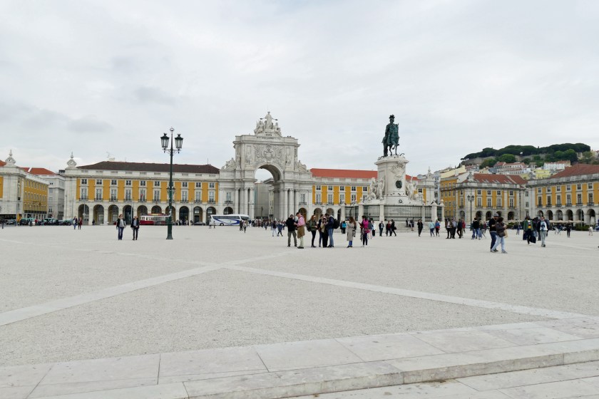
Hong Kong is in the midst of change, as China seeks to gain a stronger political grip on the special administrative region. Recent government proposals to extend Beijing’s power to Hong Kong have caused outrage amongst locals and outrage has lead to large scale protests around government buildings and an expanding range of the city, including the airport.
Naturally, all of the above had me wondering if it’s safe to visit Hong Kong right now. Though since the situation at the airport had normalized and my brother, living in Hong Kong, told us it was reasonably easy to avoid the protesting crowds, Robin and I decided to go through with our initial plans.
While I have been in Hong Kong several times before, it is Robin’s first time visiting both Asia and such a huge city. With its 7,4 million inhabitants on 1’104 square kilometres, it is almost 500 times more densely populated than Norway (5,3 million on 385’207 square kilometres). Seeing the massive high-rise neighbourhoods, immense concrete highway and railway structures, the bustling harbour on the way in from the airport, certainly makes a huge impression. Not to mention arriving at my brother’s place, one of Hong Kong’s tallest residential towers situated over Kowloon Station, where doors are opened for us by a smiling staff each time we pass the lobby. Standing by the floor to ceiling windows on the 68th floor, viewing the harbour in front and Lantau further out, is simply stunning.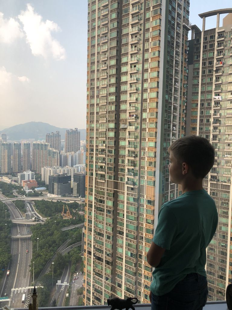
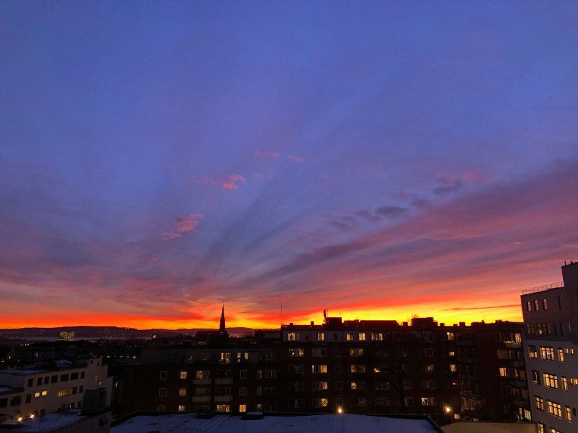
After dinner in East Tsim Sha Tsui we stroll down to Tsim Sha Tsui promenade. From here you have spectacular views of Victoria Harbour and the opposite skyline of Hong Kong Island – a good introduction to the city on our first evening.
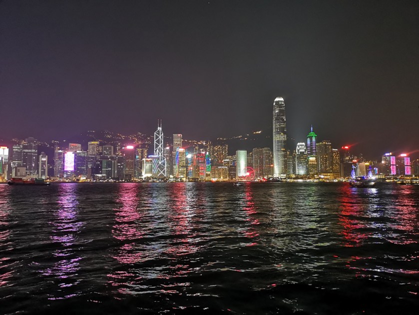
I could sit here for hours observing buildings, ships, lights and people posing, though jetlag and the different climate hits us and we are on the way home shortly after. Before turning inn, we take a short detour to West Kowloon Station, Hong Kong’s new speed rail terminus, an impressive building marked by grand steel structures, concrete slabs, huge glass panels and curving stairways up to a waste roof garden.


After a good night sleep and having checked the current situation in the city, we decide to take the bus 15 from the ferry pier to the Peak, a nice ride passing Hong Kong’s central business district before climbing up on Peak Road, following the very winding and typical Hong Kong hillside road with its many twists and turns with sudden fall offs overlooking the south side of Hong Kong island far below.


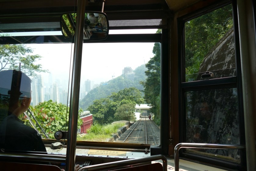
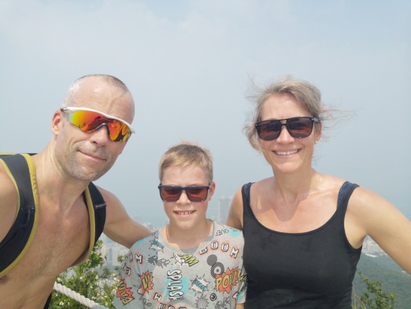
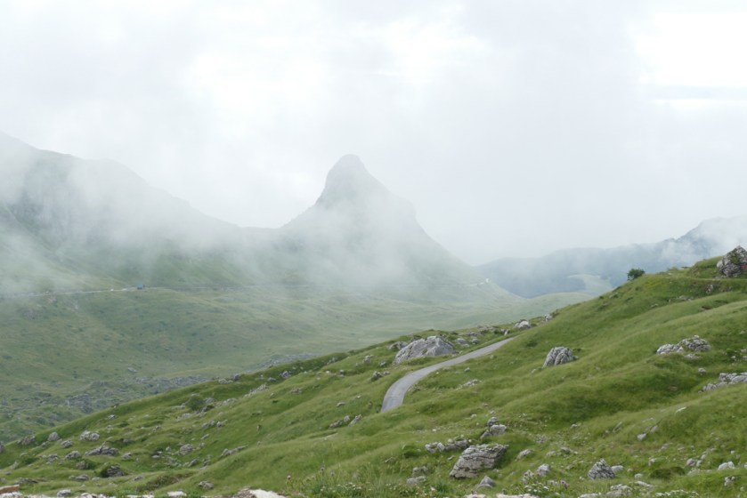
We’re riding the Peak Tram down and up again – only possible because of the almost total absence of tourists (usually you have to queue for hours) – we follow Lugard Road, a popular walking path along the hillside westwards and climb High West Peak. The view is obscured by haze due to air pollution and we can hardly make out Christoph’s building on the other side of the harbour.

While I enjoy Monday by myself visiting the Museum of Tea Ware at Flagstaff House in Hong Kong Park, Christoph takes Robin to Ocean Park, an amusement park with roller coasters, oceanarium and animal shows. They obviously have a lot of fun despite temperatures well above 30 degrees and air pollution.


On the following day, China marks its 70th anniversary and we decide to stay at home. As expected, there are huge demonstrations that day, becoming more and more violent during the afternoon and early evening. Many MTR stations are closed, as shopping malls, restaurants etc. It’s certainly wise to stay inn, and we enjoy the afternoon at the swimming pool, feeling very privileged.


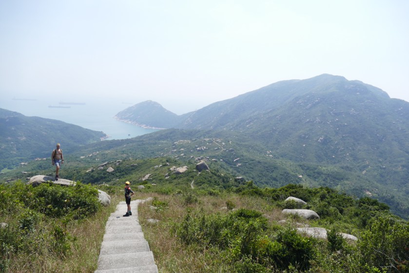
Luckily, everything seems to be calm the next day and we take a small ferry out to Lamma Island to go for a hike. The island is a really nice change to the lively city even more emphasized due to the near complete absence of tourists due to the current political situation.
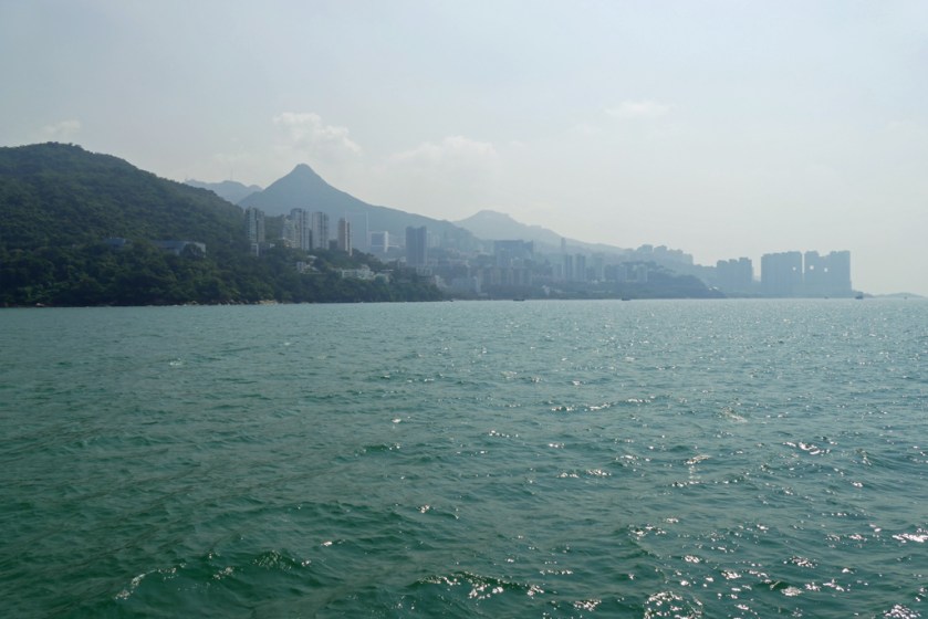


We cross the island from Yung Shue Wan Ferry Pier to Sok Kwu Wan, climb up the hill behind the little village on a terribly steep path, hardly visible through high grass and very hot… but are rewarded with an amazing view over Lamma Island with its many peculiar rocks, the south of Hong Kong Island and the sea with countless ships in and out of the harbour.


 Lunch at one of the small fishing restaurants at the shore is a highlight, and Robin proves his abilities to eat with sticks, even slippery small pieces of chicken and fish.
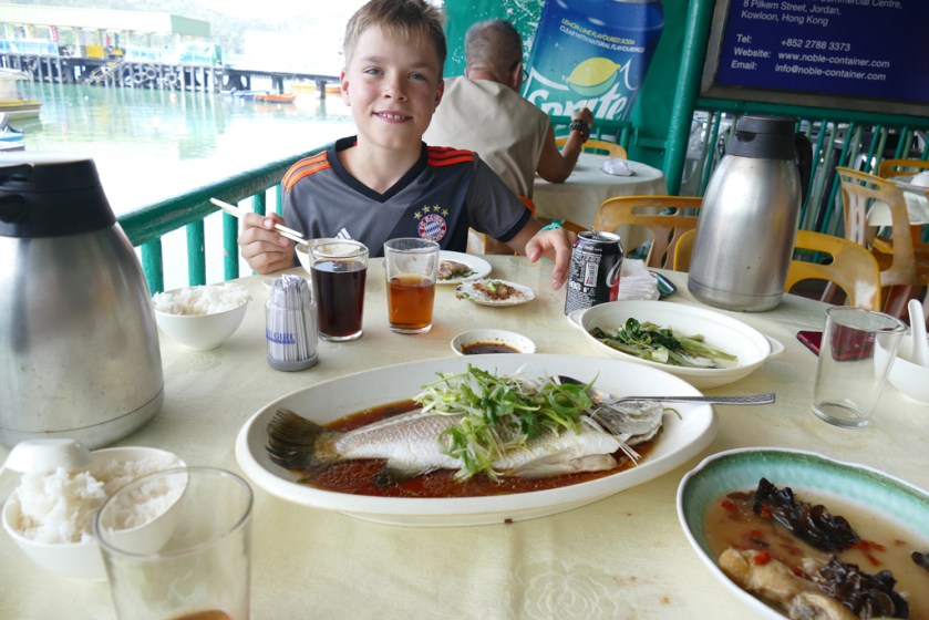
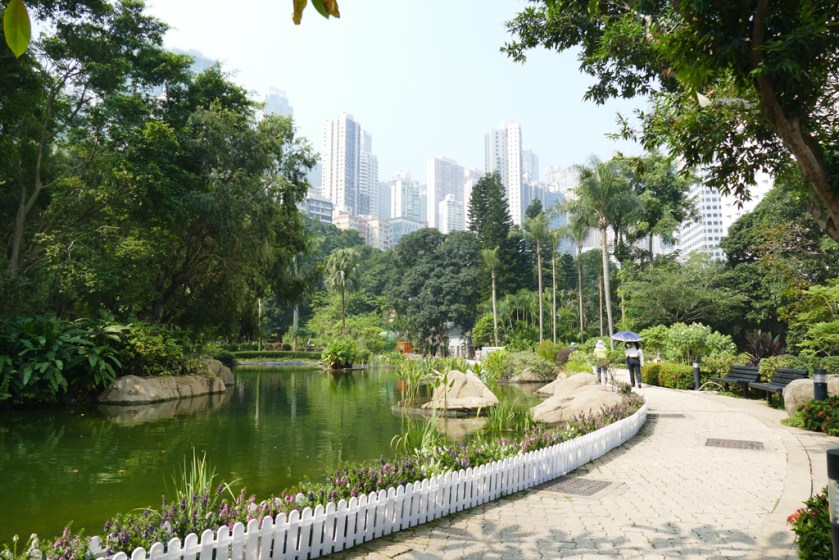
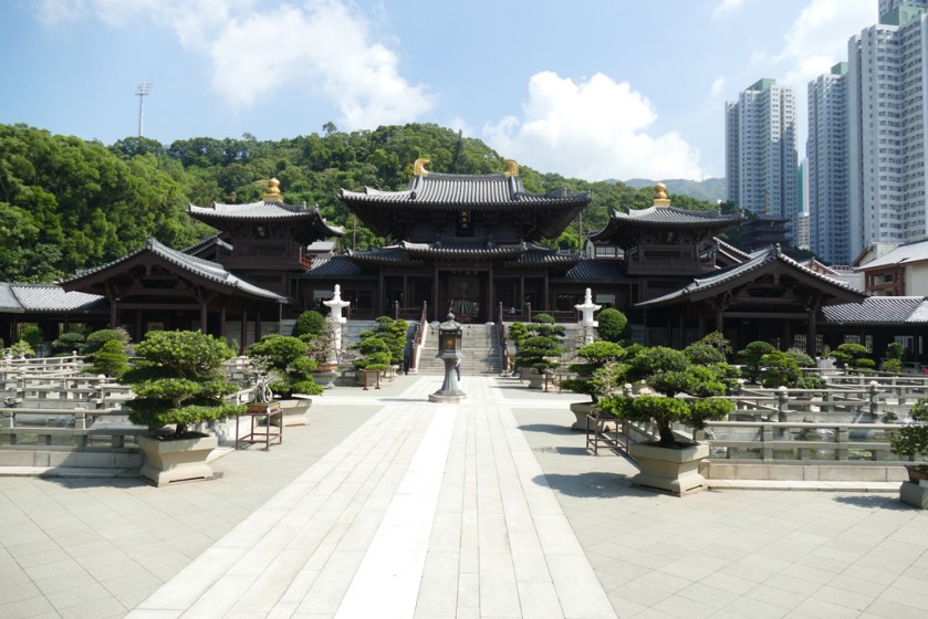
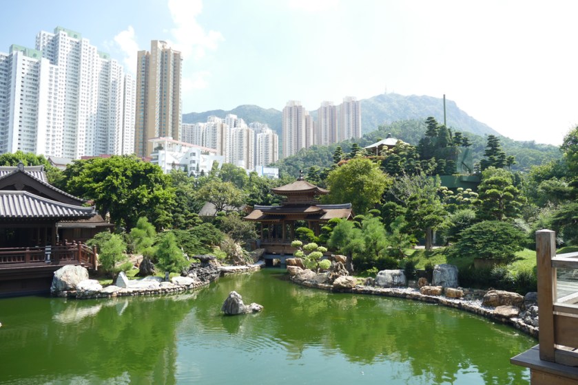
On our last day I want to show Robin two of my favourite places in Hong Kong: Chi Lin Nunnery, a large temple complex, and Nan Lian Garden, situated at Diamond Hill, Kowloon. Suddenly stepping into this tranquil and unique universe is fascinating and the contrast of the tall skyscrapers surrounding very special.


After lunch and a stroll through ‘Sneaker Street’ (Fa Yuen Street), Ladies Market and Nathan Street we are happy to get home and cool down at the pool. Neither Robin nor I are used to these high temperatures combined with rather bad air.


After six days it is time to return home again. We have managed almost everything on our to-do list, including riding a Ding Ding (tram), taking the Star Ferry and eating lots of foreign food. Christoph has taken great care of us, showing us lots of places, including many good restaurants around town. Spending time with him is always a pleasure not least for Robin who adores his uncle. I am already looking forward for travelling together with him again.


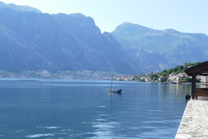 Approaching the famous Bay of Kotor from the Northeast, we first cross the rugged and very rocky Lovcen mountains – almost impenetrable in different wars in the past. Then we get a first glimpse of water far below us. Following the winding road down, suddenly traffic in front of us comes to a stop. A car in front of us just got hit by falling rocks. The passenger side window and mirror are smashed, big rocks lie on the road. Luckily, nobody got hurt and I am relieved as we reach the bottom. Instead of driving all around the bay we chose to take the ferry from Kamenari to Lepetane. A 10 minutes ride crossing the bay at its most narrow section, only 340 metres wide. During WWII they had hidden a massive metal chain below the water surface at this very spot, to prevent hostile ships coming in.
 We then drive into Kotor and spend half a day in this beautiful town which is included in UNESCO’s World Heritage Site. The old port is surrounded by fortifications built during the Venetian period between15th and 17th centuries.


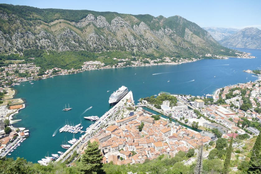
 The castle is part of a huge fortification system that protected the medieval town, containing ramparts, towers, citadels, gates, bastions, forts, cisterns and other buildings. The size of it is simply impressive. After a small lunch in town we get onboard of a small speed boat, having booked a half-day tour. This landscape certainly deserves being seen from the water.
 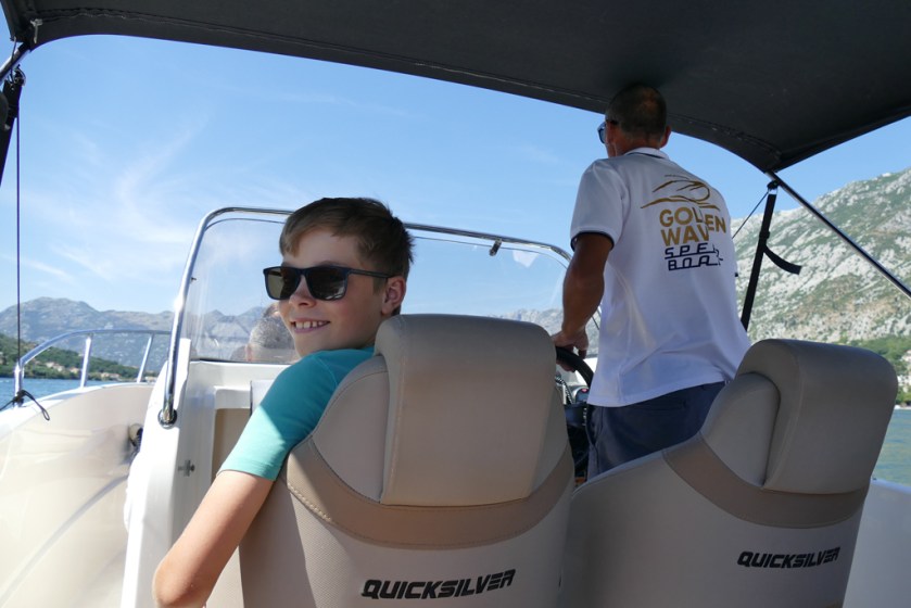 Our guide takes us first to the two islets off the coast of Perast: Gospa od Skrpjela (Lady of the Rock) and Sveti Dorde (Saint George). Sveti Dorde contains a monastery which is not open to the public. Gospa od Skrpjela is an artificial island.


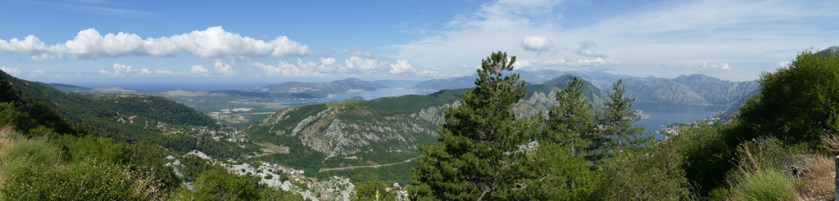 Later that day we stop at Cetinje, the old royal capital of Montenegro. Many stately mansions dating from the days European ambassadors lived here, share the same street as singe-storey cottages of very simple standard. A colourful and lively little place, again full of history.


 In the evening the sky doesn’t look promising and just after 11 pm it starts. First thunder and lightning over the mountains further inland, then getting closer and closer. An hour later we are in the middle of it, lightning close by and deafening thunder. We end up sitting in the car for an hour or so, feeling a little safer there than in our tents. It is a scary experience I must admit, but all goes well in the end and we are back in our sleeping bags for the rest of the night.
 Driving through Serbia the next couple of days is beautiful, though finding camping turns out to be more difficult than expected, not having good maps or apps telling us where the campsites are. On the other hand, we are invited to a glass of Raki the next night, close to Sabac. The old couple owning the camping doesn’t speak a lot of English, but we sit down around their table and have some kind of a conversation anyhow. Serbian hospitality!


 Hoping for better weather we continue south, visiting two orthodox monasteries, Piva and Ostrog. The first famous for its frescoes, the second for its dramatic location, situated against an almost vertical background, high up in a large rock.

 Moving from Switzerland to Norway many years ago, I got lots of comments about how alike these two countries are: high standard of living, mountains and good milk. This is obviously true, provided that one only looks on the surface. However, it didn’t take me many months to realize how contrasting these two countries are. I won’t talk about working hours, childcare or taxes which clearly are quite different. I rather tell about the Norwegian National Day. Norway’s celebration of their own constitution set up on May 17, 1814 and their own king, is certainly a rather unusual event. While many Swiss people are abroad on summer holidays on the Swiss National Day First of August and celebrations are quite modest, what is going on in Norway is on a totally different level.
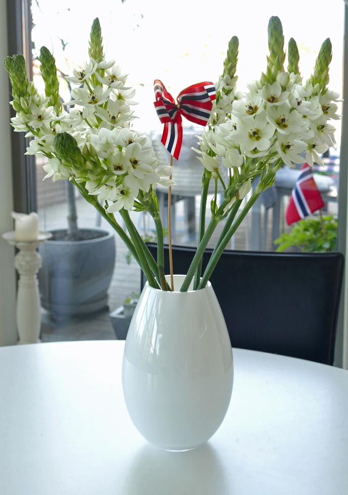 Anyone in Oslo on May 17 should be prepared for large crowds of people waving flags and shouting “hurra” and “gratulerer med dagen” (“congratulations with the day”). The red, white and blue colours of the Norwegian flag are everywhere, and more and more women and men are wearing immaculate, intricate national folk dresses, the so-called bunad.
  Nationalistic? Yes! But in a positive way if you ask me. It’s totally non-militaristic and the atmosphere is generally joyous. And most important: it is the children’s day. The morning is spent watching processions of marching school children with their bands parade proudly past the palace. Kids from more than 100 schools in Oslo are waving to the crowds and are greeted by the royal family who are waving tirelessly and for hours from the Royal Palace balcony.


 I wouldn’t be giving you the whole picture if I didn’t mention the importance of alcohol – there’s obviously a lot of drinking going on both in parks, outdoor cafés and private parties. People start drinking early and don’t stop until late. But again, the atmosphere is usually happy and relaxed, and we could just return to our roof terrace and end the day peacefully with the obligatory barbecue.