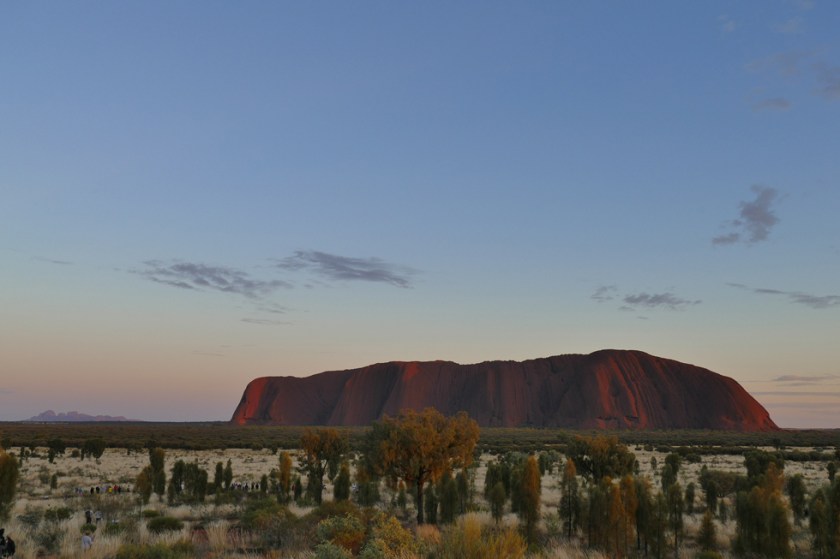
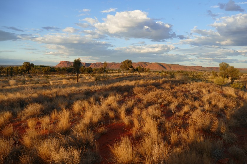
 Travelling in the Red Centre to places like West MacDonnell Ranges, Uluru and Kata Tjuta came almost as a little shock to us. After many days in remote outback areas, having the road and campsites to ourselves, we were suddenly met by lots of travellers from Asia and Europe in their big motorhomes, crowded campsites and parking lots at the different sights. It’s easy to understand though why so many choose to travel here – it’s here in the Red Centre where you find the most known, most photographed and most iconic attraction of Australia: the Uluru. Or just the Rock, as the Aussies often call it.
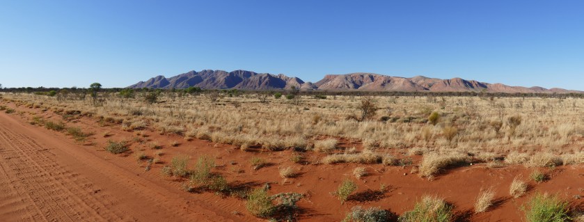
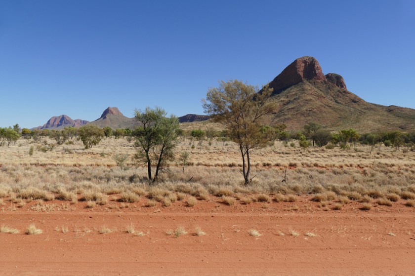
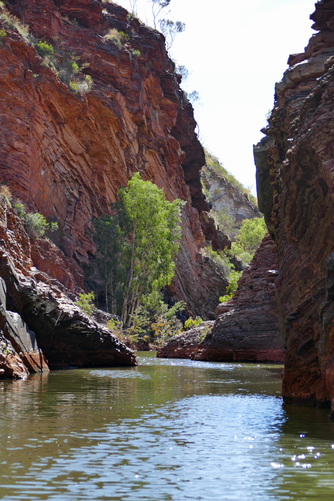
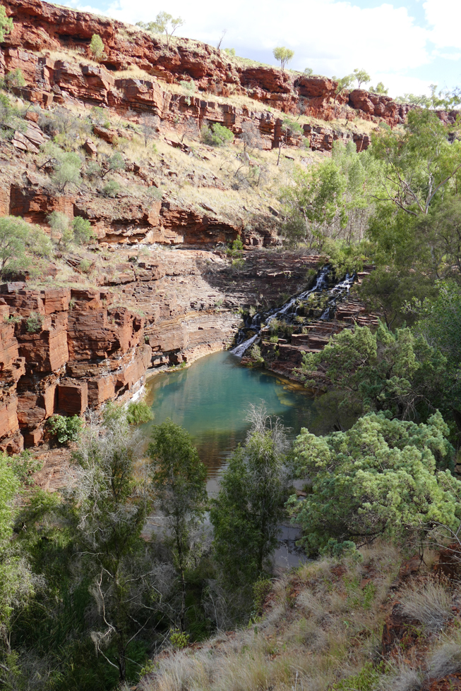
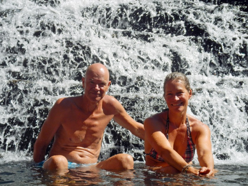
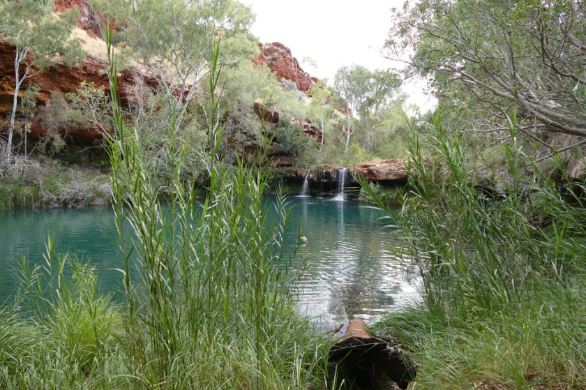
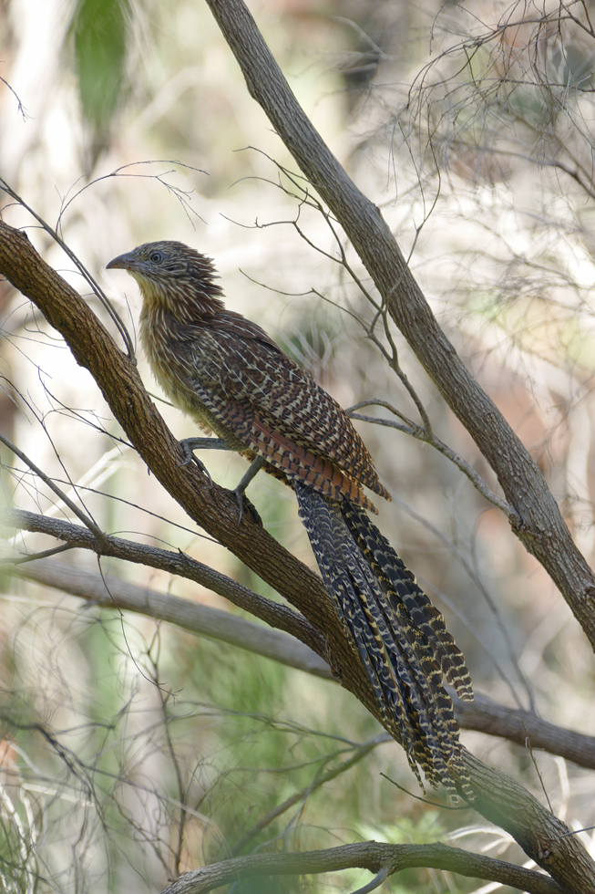
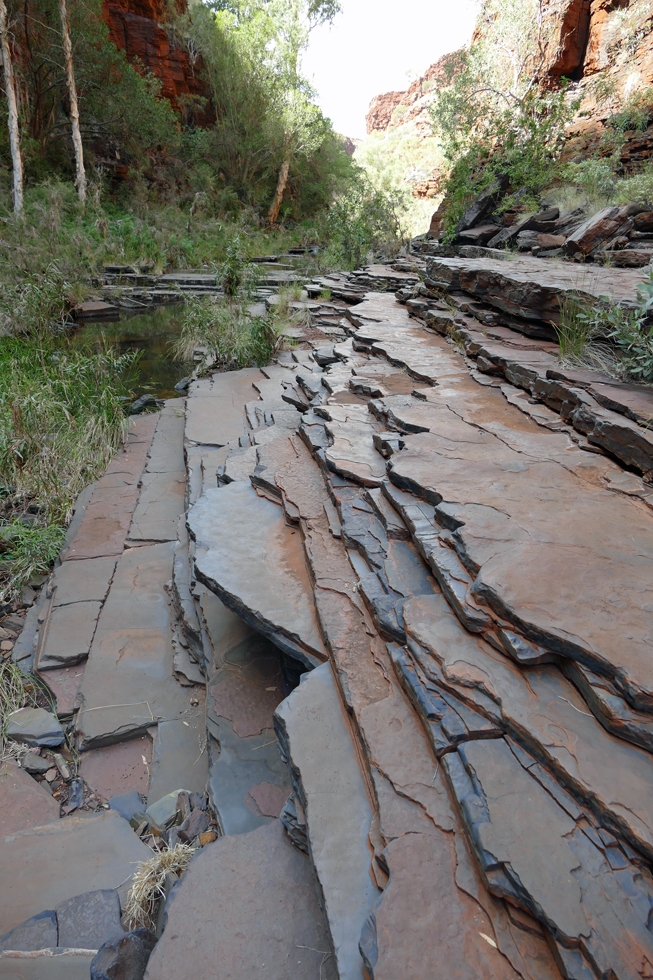
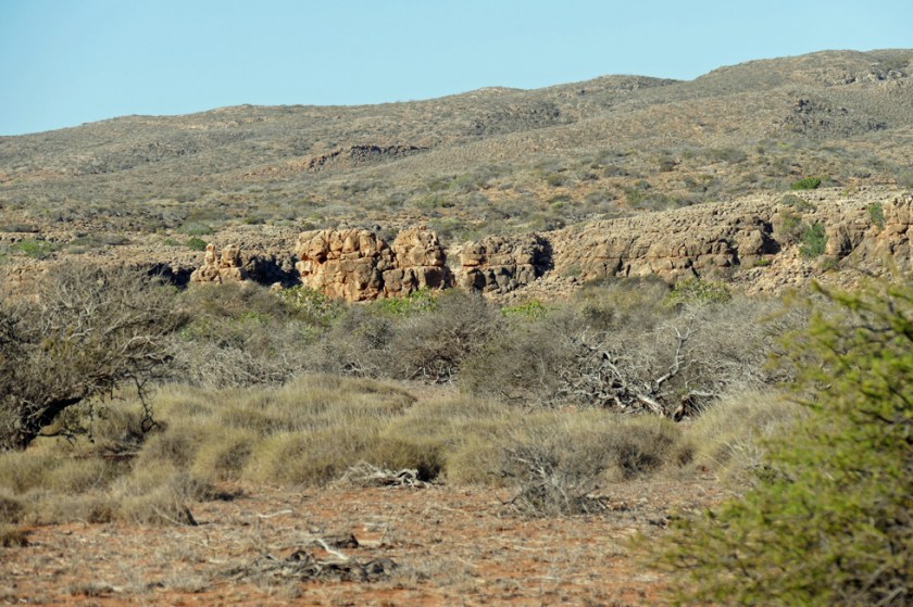
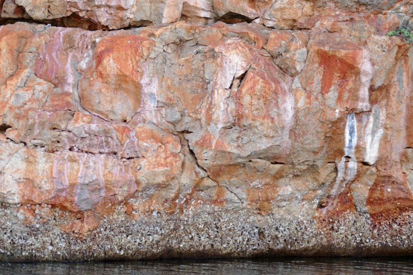
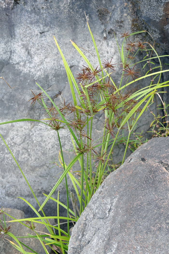
But before we got that far, we spent some days in the West MacDonnell Ranges, visiting Glen Helen, Ormiston and Redbank Gorge. At Ochre Pits we went to see the colourful cliffs where Aboriginal people obtain different coloured ochres. Aboriginal people use ochres for ritual body decorations, and the ochres are also considered to have magical properties and are used as medicine. We continued to Gosse Bluff, a spectacular crater that formed when a comet crashed to earth some 140 million years ago. We were quite impressed with the dimension, the diameter of the crater being about 5 kilometres.
In Hermannsburg we visited the historic mission settlement, first settled by German Lutheran Missionaries in 1877. Hard to imagine what life was like in those days, as we wandered about the whitewashed walls of the church, school and other restored houses.

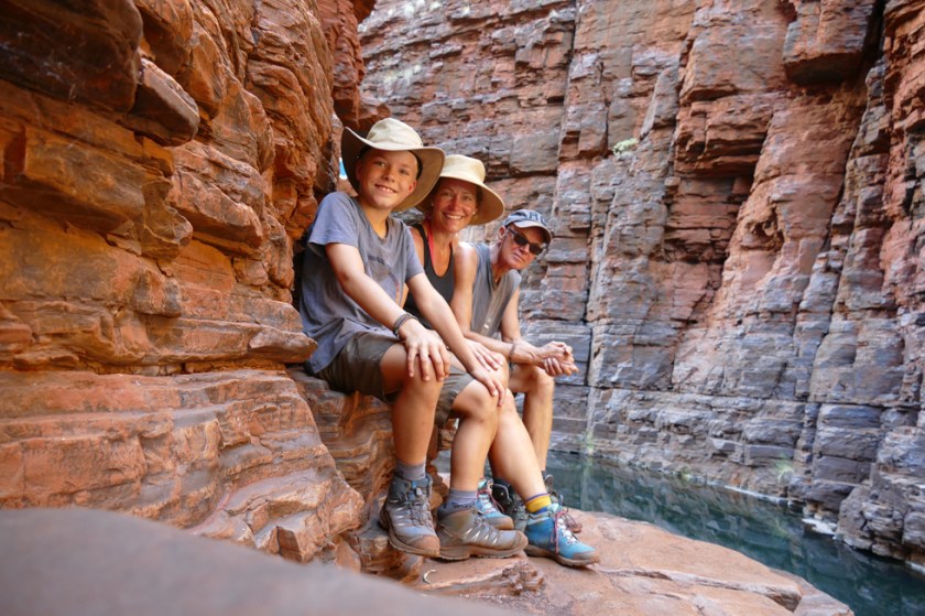
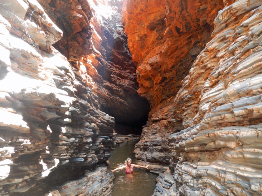
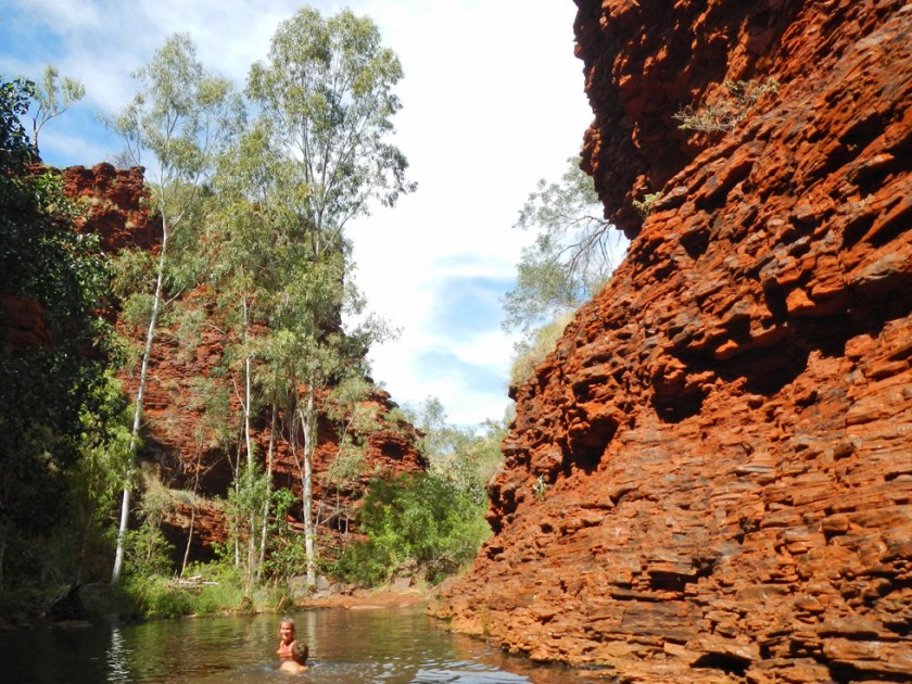
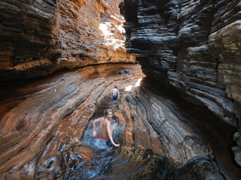
We didn’t feel like staying at this Aboriginal community and drove on to Palm Valley, an outstanding 4WD destination. There we stayed at the most beautiful campsite, did some great walks and relaxed in these beautiful surroundings.


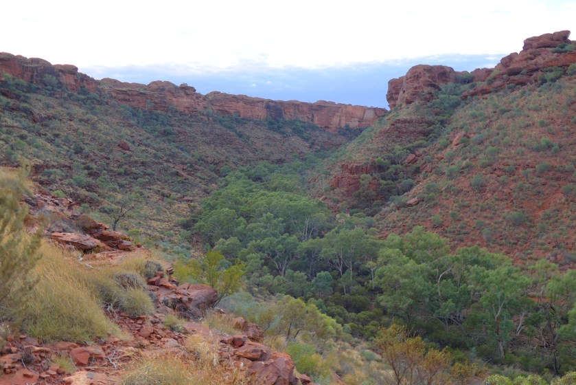
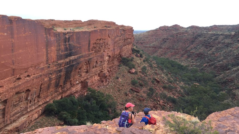
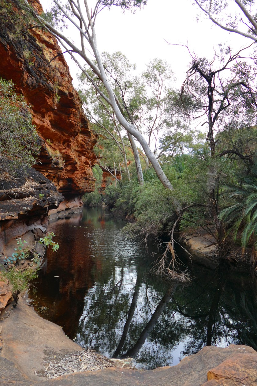
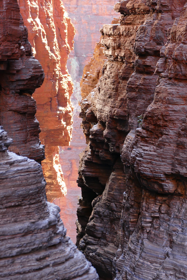
Next stop – one of the must-sees in the Red Centre – was Watarranka National Park with Kings Canyon. There is only one campsite in the area, which means they can pretty much do as they like. We felt it was quite a tourist trap, expensive and not the best service. We had hoped to get some food at their little supermarket, but the fridge in the shop was out of order, so they didn’t get any supplies. Of course, the guests are welcome at their restaurant… Luckily, we had just enough food to make it through the next couple of days, but I really missed some fresh fruit and veggies!
One morning we did the stunning Kings Canyon Rim Walk, starting with a steep climb up tough rocky steps to the rim of the canyon, from where we enjoyed fantastic views. We walked through the massive weathered domes of the so-called ‘Lost City’ and admired the soaring red cliffs rising 100 metres above the surrounding plains.

On our way to Yulara, the tourist town next to Uluru, we stopped at Karrke Aboriginal Cultural Centre, where we did a one hour crash course in Aboriginal culture. We watched spear and boomerang displays, learned about bush tucker and bush medicine, local languages and dot painting.


The small town of Yulara was established in the eighties to cater for the ever increasing numbers of tourists. We were very positively surprised, not only by the town itself, but most important by the fact that the town seems to be run mainly by the indigenous population. There is information about their culture everywhere, signs are written in English and their own language, indigenous rangers do tours telling about their history. When travelling to Uluru and Kata Tjuta, it is very important in my eyes to know about the significance of the creation story. I will not go too much into details, but I would like to tell you this: The land was created by the creation ancestors. In their travels they left marks in the land and made laws for the indigenous people to keep and live by. The details of their activities and travels have been taught in stories, songs dances and ceremonies. When the Aboriginal people travel across the land, they can see the physical evidence of the activities of the ancestral beings and use them as landmarks to find their way. Some of these places are sacred. That can mean that we as foreigners are not allowed to go there, or sometimes should not take pictures. I find it easy to respect that and wouldn’t ignore their wishes. I find it on the other hand very hard to understand why still so many people chose to climb the Uluru. The Anangu people ask very clearly that we respect their wishes, culture and law and don’t climb it. Unfortunately, it is not illegal yet (it will be from next year) and many people see it as their last chance to climb it.
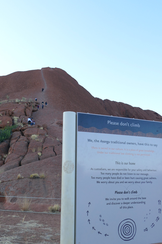
We did the base walk instead, which was quite beautiful as well. At first glance, Uluru may appear as one large smooth monolith but up close we saw numerous interesting rock formations, gullies, caves and crevices. As we walked around it we tried to imagine the fact that we were not just looking at rocks and walls; we were walking in the middle of a creation story the Anangu people tell.


Even more spectacular was the ‘Valley of the Winds Walk’ through the Kata Tjutas, which means ‘many heads’. It includes 36 domes of different sizes, the highest one rising 546 metres above ground level, which is 198 metres more than Uluru. It was quite amazing to walk through this landscape of red rock, lush green valleys and stunning views.


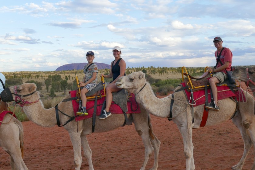
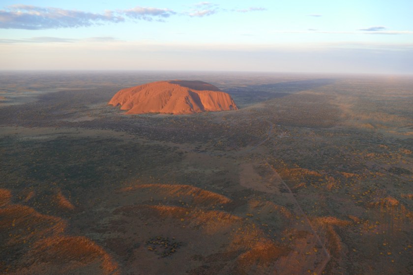
There is plenty to do in Yulara, exclusive outdoor dinners, dot-painting courses, balloon flights etc. We chose to ride on camels one evening and went on an unforgettable helicopter flight the other. Everything costs a lot of money, but I guess it is only once in a lifetime that we’re here, so we didn’t want to miss out on something. We’ll soon enough get back to our pretty simple and modest lifestyle.


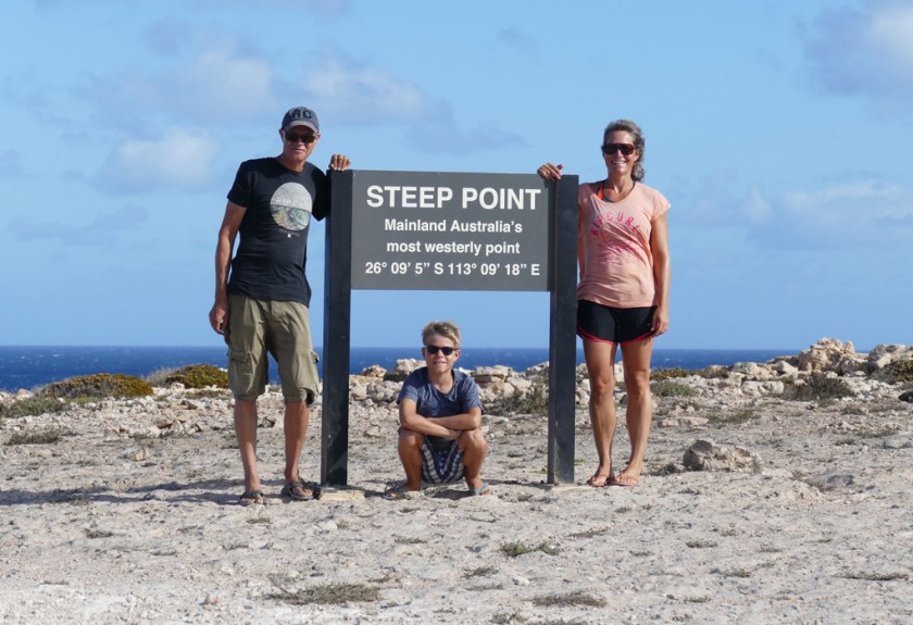
 A
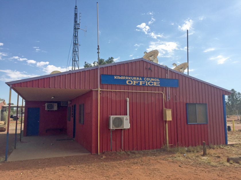
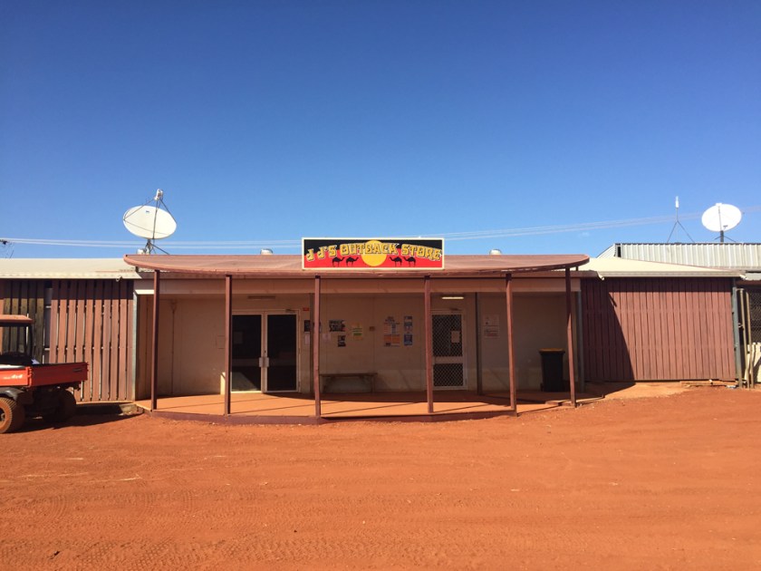
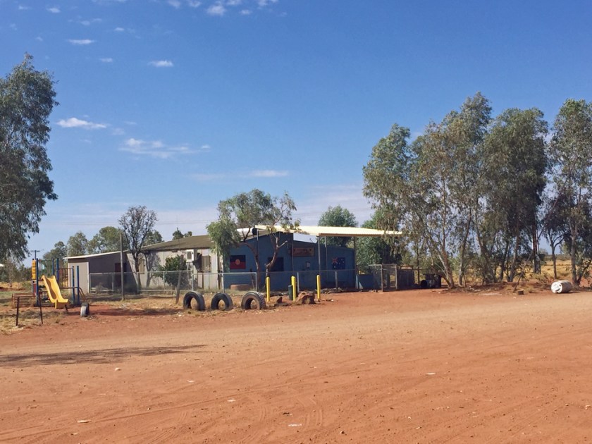
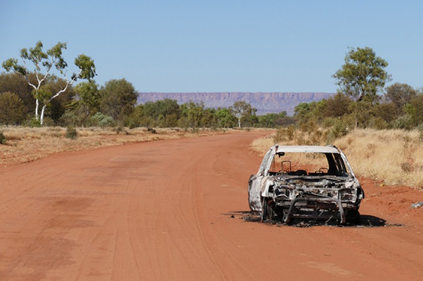
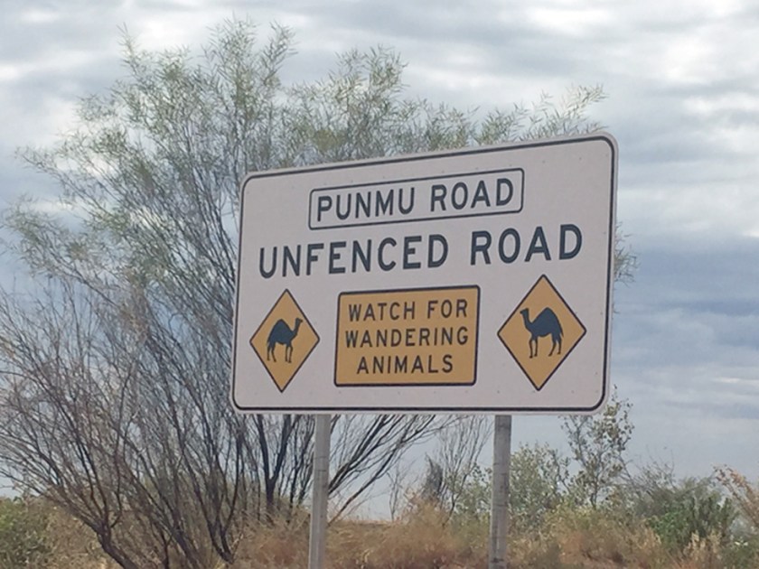
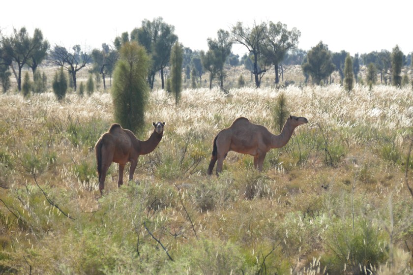
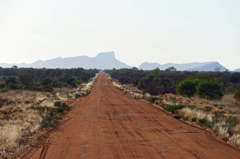
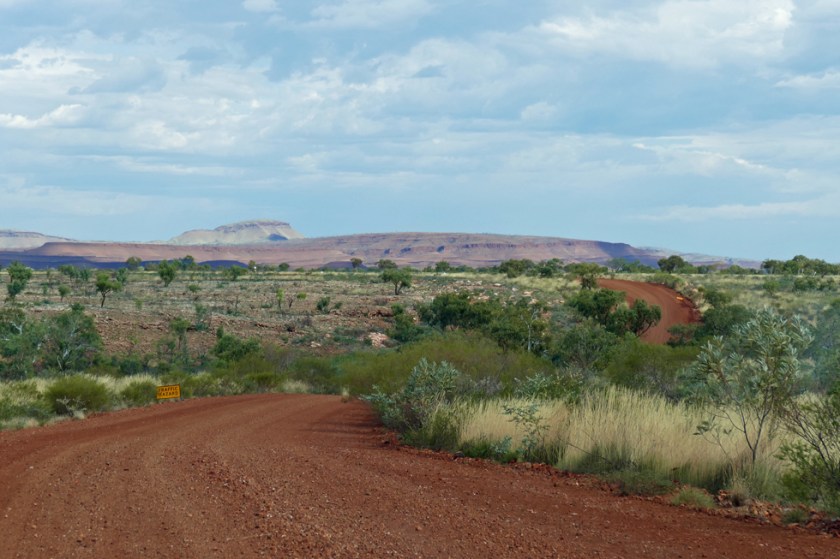
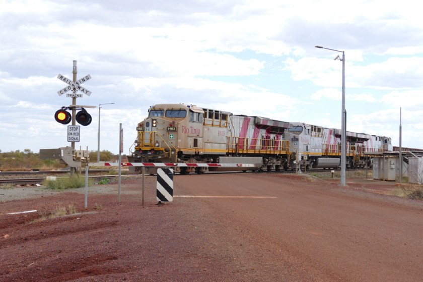
A The first part from Marble Bar was on bitumen roads due to mining activities in the area. We met many road trains and service cars, but no other travellers. After passing the last mining site, we continued on a good gravel road until Punmu, our first Aboriginal Community. We didn’t really know what to expect – the map told us that there would be a gas station, shop and possibility to stay overnight. Driving into the village was not a nice sight, garbage and car wrecks everywhere, rundown houses. We found the shop and went in, adults and children were hanging in front of it, curiously looking at us. The lady behind the counter, a white Australian, seemed surprised when she heard that we were planning to spend the night in the area. She sent us over to the office, where her husband, the community’s manager, would get some diesel for us.


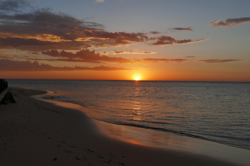
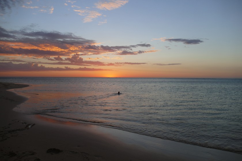


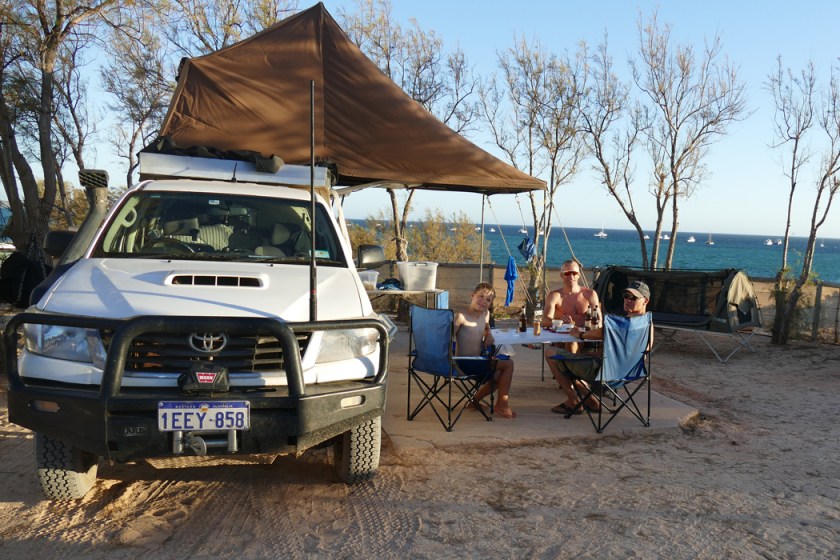
 It’s been over two weeks since my last blog post and there are several reasons for that. The main one is that Robin has been suffering from a “Swimmer’s Ear”, a very painful inflammation of the outer ear. It’s often caused by extensive swimming in not so clean swimming pools and constant humidity in the ear canal. Don’t blame him – it was the only way to get us through days with extremely high temperatures (the other reason why I didn’t write anything on my blog). First time we went to see the doctor in Carnarvon, about 150 km away from Red Bluff, where we had spent the night.


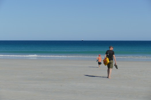
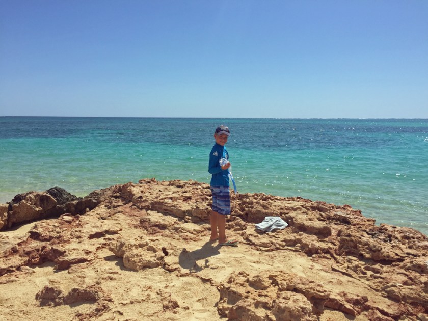
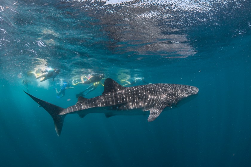
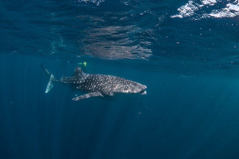
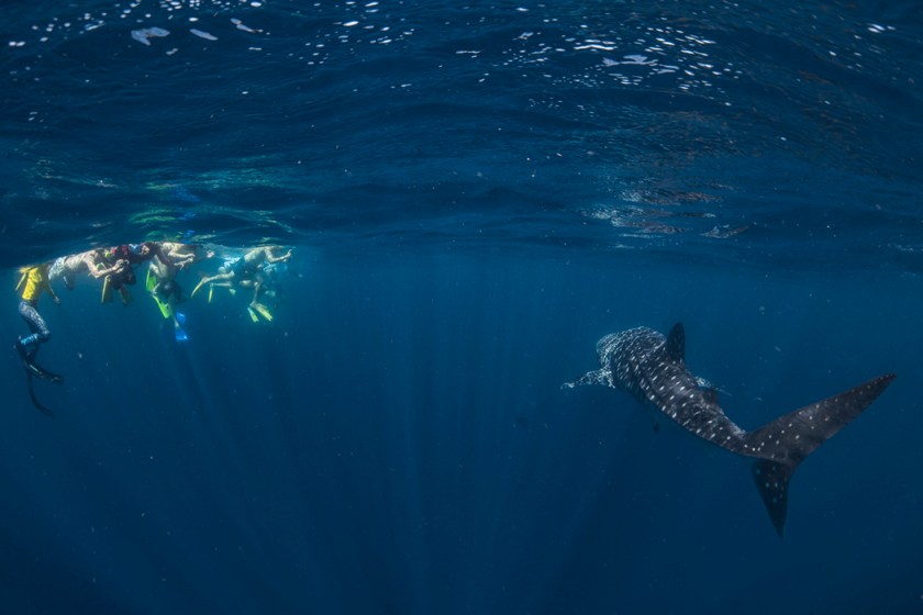
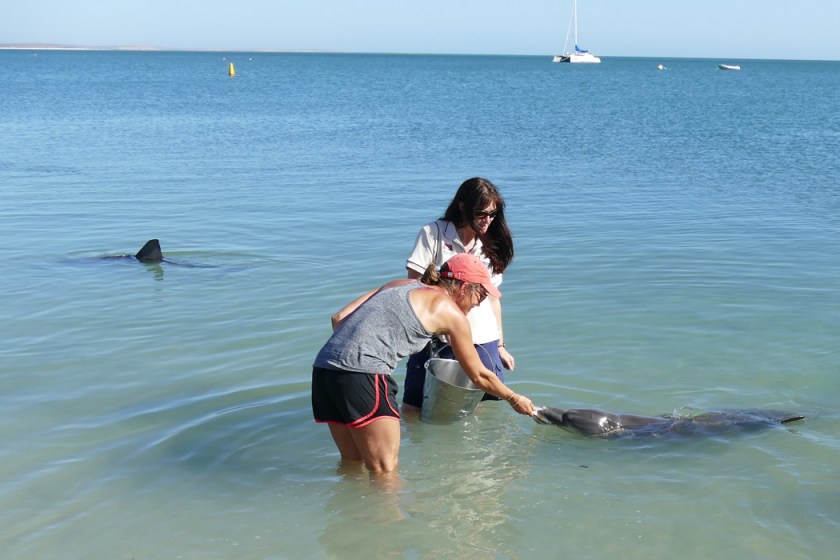
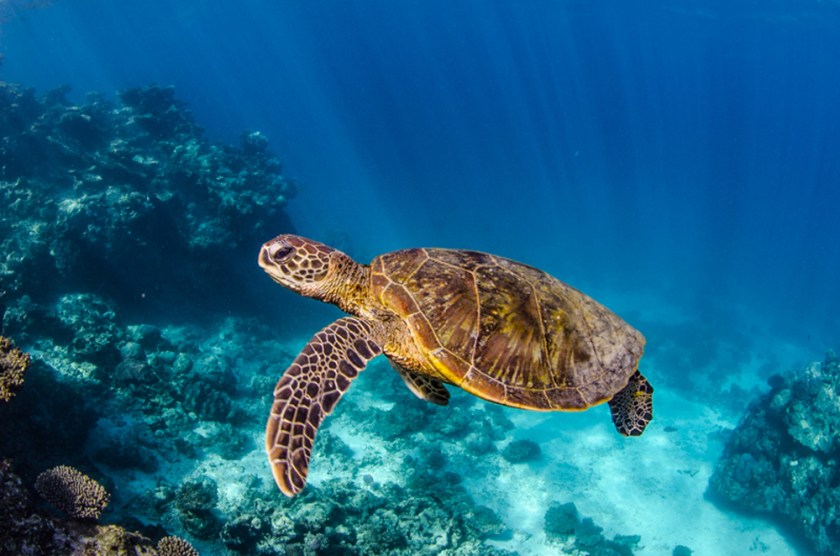 After that day on the ocean I had made up my mind: I wanted to swim with the famous whale sharks. Every year from March to August, the world’s biggest fish congregate along the Ningaloo Reef. These creatures can grow up to 15 metres long and have a life span of up to 70 years. Their name comes from the fish’s physiology, being as large as some species of the whales and being a filter feeder. And they are totally harmless to humans. So, I couldn’t let go this once in a lifetime opportunity! And I managed to convince Dag and Robin to join me. When we got to Exmouth, our next destination, we booked a tour with “Whaleshark n Dive”. You might think it’s scary to swim with these giants. I can assure you, it is not. The crew on board made sure we got into the water the right moment (they use spotter planes to locate the sharks), lined up on the right side and dived under just when the whale shark passed slowly by. What really was scary – at least for me – was to jump into heavy swell far out in the Indian ocean. It took me and Robin quite some will power, but we never regretted it. It was truly unforgettable! And allow me to say how impressed I was that Robin joined me, that was so brave of him. But we both prefer to snorkel inside of the reef, in shallow water where we see the bottom! The beautiful underwater photographs are taken by Jess Hadden, a professional underwater photographer and member of the crew.
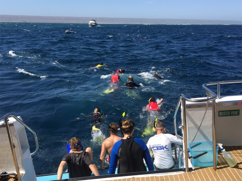


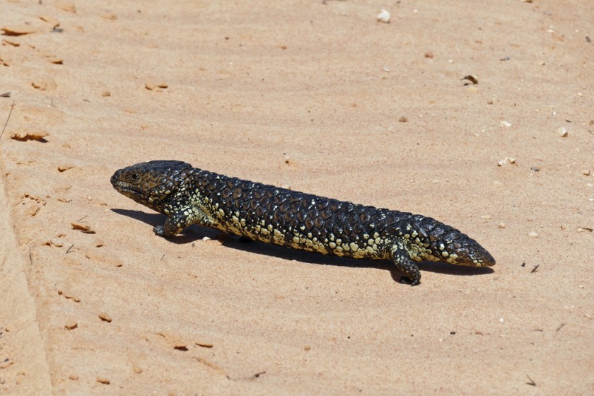
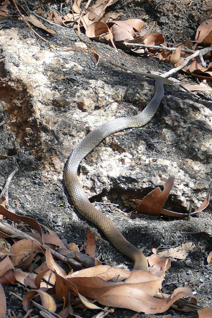
 After almost three months of travelling, I can truly say that this is the best thing we’ve ever done, no doubt. We are writing our history, creating many good memories. At the same time, it is not just a walk in the park. The way we travel, we’re so exposed to nature. And that means quite a challenge here in Australia. I’m not even thinking about the all the dangerous creatures we meet. More challenging is the heat, strong winds, the cold at times, or heavy rain. And there we are in our small car with roof top tent, trying to keep our spirits up and make the best out of it. And believe me, we usually succeed. Except when the flies attack us. Because they are so much worse than the heat!
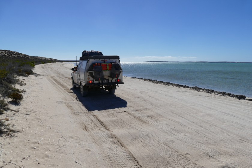


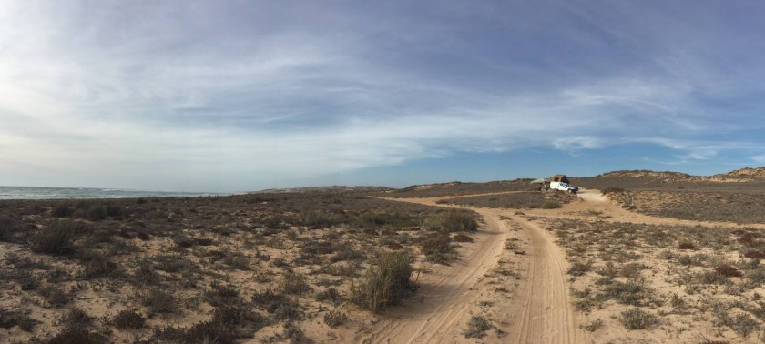
 It was not very far, around 25 kilometres, but it took us several hours. Again and again we had to stop to admire the view, or check the track before driving it, since there were many steep and soft sandy parts and others with sharp rocks. We even got bogged at one point, but thanks to our Maxtrax, we got out easily.


 We stayed three days in this area, drove on a few 4WD tracks, spent an afternoon in Margaret River, a little town famous for its wineries and surfing and visited a couple of caves. The Margaret River Region is home to over 100 caves, which have been formed over the last 1 million years by the constant movement of water through limestone. We liked especially Lake Cave with its stunning crystal wonderland and the only cave in the Leeuwin-Naturaliste Ridge with a permanent lake. The cave is renowned for the ‘Suspended Table’ – a five tonne column of calcite that hangs from the ceiling just a few centimetres above the lake.


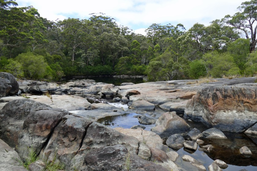 We’ve been spending a week in the Southern Forests, an area between Albany and Augusta, a three-hours drive south of Perth. We didn’t know much about these forests and were totally surprised and impressed by their beauty! The so-called tingle forest is a very ancient forest. Its trees only occur in this small area and provide a window to the past. Some of the plants, we learned, have origins that can be traced back 65 million years to the super continent Gondwana, when Australia was joined with what is now Africa, India, Antarctica and South America.


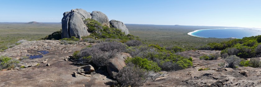
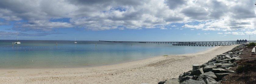
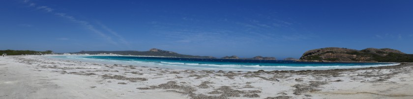 Esperance in Australia’s Southwest is known for its beautiful beaches, and Lucky Bay is the one everybody wants to get to. Camping is limited to 50 sites and you must arrive early, before nine, to grab a spot that might get available. So that’s what we did, left Esperance early morning and drove the 60 kilometres to Lucky Bay. We were car number three when we arrived there just after eight. And we were lucky and got a great spot in the lowest row, surrounded by low gum trees and with a stunning view over the bay. Spending the day snorkelling, reading, relaxing and playing games, we felt quite lucky at Lucky Bay.


 Unfortunately our happiness didn’t last too long. When it was time to go to bed it started raining, and it hasn’t stopped since. Right now I’m sitting in a barbecue shelter and the rain drums loudly on the tin roof. The night was not too bad, the bed only being humid, not wet. We had breakfast in our tent, just enough space for three chairs and a table, though not enough space to spend the day for the three of us, so I really hope the rain will stop, the sun will come out and we can hang out our humid sleeping bags and sheets.