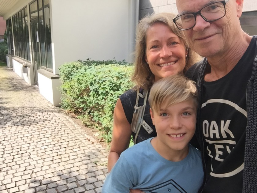
It’s been a while since last time… summer has passed, autumn likewise. Suddenly it was one year ago since we left for Australia. I would be lying if I’d pretend that this didn’t affect me emotionally. How much I wished to turn back time and start all over again. But luckily, I am reasonable enough not to get too frustrated and rather look forward to positive events. Like travelling to Switzerland for Christmas, meeting up with my best friend and her family for 24 hours, followed by a week at our family holiday house in the Alps, together with my parents, my aunt (living here permanently since retirement) and my brother, who came all the way from Hongkong.
Our ‘Wyss Hus’The little village of Jenaz
It’s a beautiful old house in Jenaz, a small village in the canton of Graubünden. This is where we spent both summer and winter holidays in my childhood, and always Christmas. The house is full of memories and it still feels a bit like coming home. Only a pity that Dag stayed in Oslo, spending Christmas with his mother and his two grown-up kids and their families.
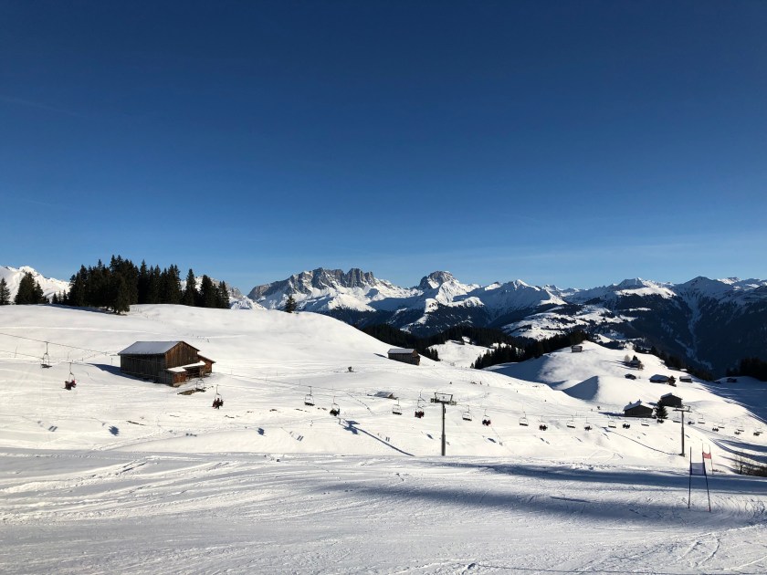
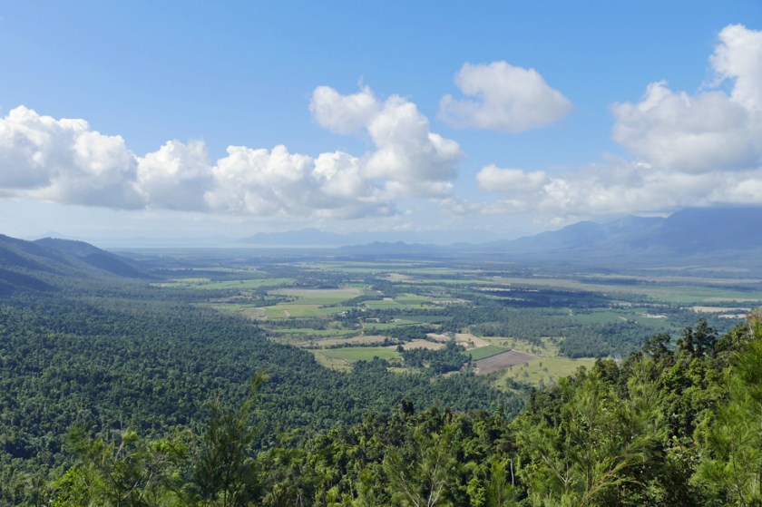
After a couple of days with heavy rain (not really helping my lack of Christmas feeling), we finally saw the sun again and enjoyed the rest of the week with blue skies. Jenaz, lying on the bottom of the valley, hasn’t got any snow yet. There’s also little sunlight down here in winter, just a few hours in the morning. It has therefor become kind of a family tradition to drive up to the village of Pany and walk from there to Alp Tratza, an idyllic Maiensäss settlement at 1600 m above sea level with a wonderful panoramic view over the whole Prättigau and magnificent mountains.
Alp Tratza
Here we both enjoyed the sun and a lot of snow. The owners of the Maiensäss have put up a container, tables and chairs, and offer hot and cold drinks and small meals. The typical “Huus Gaffi” (=house coffee) with schnapps and whipped cream tastes delicious in these surroundings! The second day we walked up, Robin even brought our old wooden sled and we had a lot of fun on the way down, after another “Huus Gaffi”.
Beautiful wooden architecture
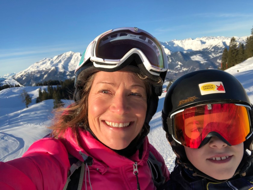
Robin and I seized the opportunity and went skiing for one day. It’s been many years, well actually decades since last time here in Switzerland and it was great. Being surrounded by this beautiful landscape with all its snow-covered mountain tops is truly special. We tried all the lifts and all the different slopes, only with a short break at lunch on the sunny terrace of a traditional mountain lodges. We just enjoyed being outdoors and moving.
View towards Sulzfluh
The week went by quickly. Days filled with long breakfasts, walks, playing games and cosy dinners.
Early morning view from our kitchen
The hills around Jenaz
Now it is time for returning home and spending the last days of this year with Dag. We’ll be looking back, remembering our unforgettable trip through Australia. But we’ll also be looking forward towards the new year, where new trips are awaiting us. Portugal in spring, then a long road trip through Europe in summer. It might not be the same driving through densely populated countries in Europe, but it will still give us a feeling of freedom, being able to travel that way, stop where we like, put up our tent and just take it as it comes. This is the way we like it. This is our way of living the dream. Work, save, travel, repeat.
A week has passed since we came home last Sunday. It feels like having woken up from a long, beautiful dream. I have to pinch myself in between, telling myself that it actually is real, all the memories, all the pictures in my head. And it’s just a week ago.
It is impressing how quickly we get used to our ‘normal’ life, we just slide back into our old habits. And I guess this is the way it should be.
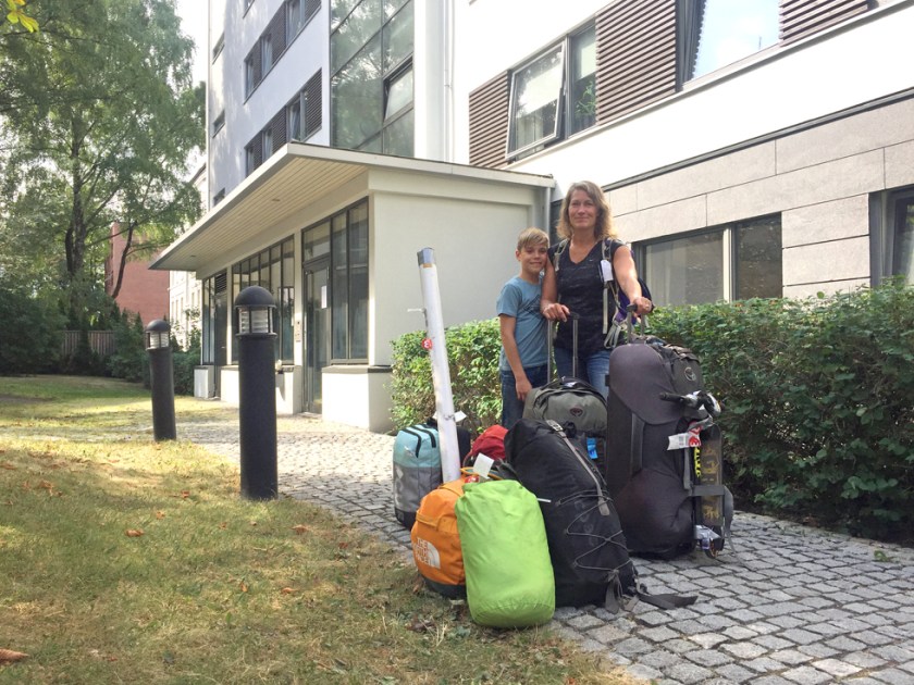
After a long trip home, 34 hours all together, we stood in front of our building Sunday morning and Robin had the biggest smile on his face, telling us that he was so excited to finally be home again. Forgotten were the tears and despair at our departure. It felt weird though, opening the door to our flat, still quite empty after renting it out the past months. Didn’t really feel home yet.
Standing in front of our apartment block in Oslo
The weather couldn’t have been any better – it is actually warmer here in Oslo than it was in Northern Queensland. So in between carrying up boxes from the basement and unpacking our stuff (incredible how much we stored away…!), we spent the afternoons at the beach, enjoying the beautiful fjord. Swimming without crocs, sharks and jellyfishes is quite nice, I must admit!
What helped me most through the first week (I would be lying if I pretended it wasn’t a shock coming home), was meeting up with good friends. It is great to see them again after all this time! And it gives us the possibility to tell about all our experiences, adventures and challenges.
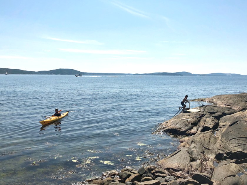
Visiting friends at Filtvet along the Oslofjord
During the coming weeks I’ll also be going through thousands of photos, trying to sort them in one way or the other, remembering the places as I look at them. We’ll hang up our big painting which we bought in the Red Centre, bringing the starry sky of the outback into our living room. And at one point we’ll probably start talking about our next trip to Australia, because one thing is crystal clear: we haven’t seen enough yet!
So this is it. 207 days have passed since we started our big adventure. 207 days full off big and small highlights, challenges and new experiences. 29’961 kilometres driven. We have seen more than we could dream of, met more good people than we could wish, had more fun that we possibly could imagine. We never run in any kind of serious trouble, our car never broke down, we were never seriously ill (except for Robins very painful but harmless ear infection), didn’t even get a flew despite very low night temperatures in Red Centre. We didn’t run out of money, sever short of water or short of fuel. We never got tired of seeing new places, driving to new sights, walking to another lookout. Our curiosity never took an end. And best of all: we are still friends! Know each other better than ever, know our limits, our strengths. Dag is the perfect driver, careful and experienced. Robin is the indispensable spotter – without him we hadn’t seen certain damages on the car and I wouldn’t have seen all the birds. Kids just see the world more attentively. When it comes to myself, I guess both Dag and Robin agree that I have been the perfect cook, serving varied dinners every night, never short of anything, often trying out new dishes. What else can I say than this trip has been a tremendous success.
Sitting on the plane towards Singapore now, both Robin and I have been close to and in tears several times during the last 24 hours. It is just so hard to accept that it is over now. As Robin put it: “The best part of my life is now over!”. Luckily, we all know that he will soon get over it and realise how lucky we are, taking home all these beautiful memories and experiences.
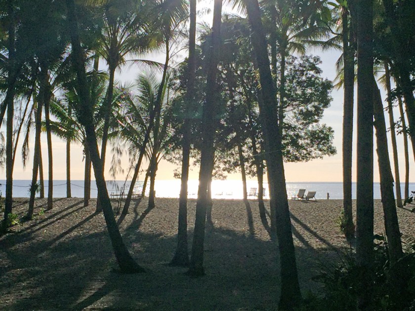
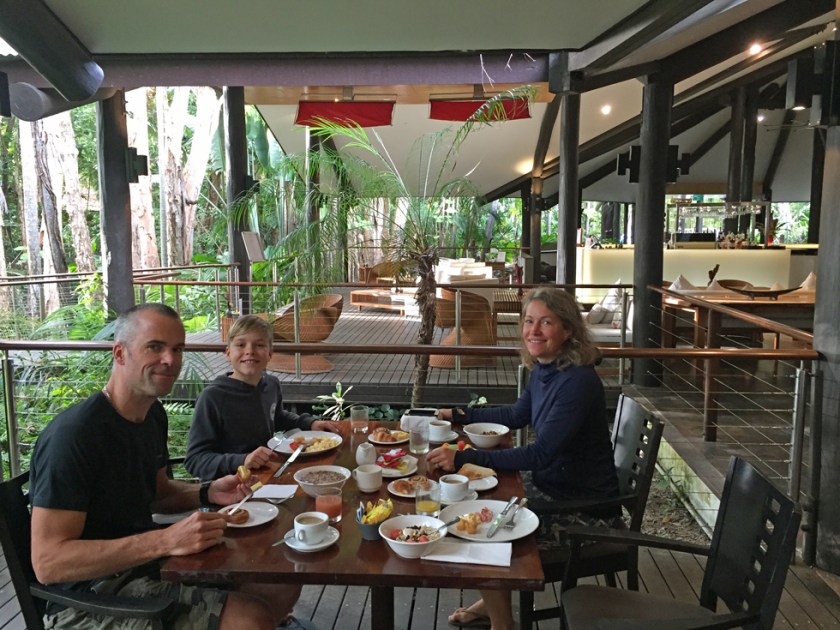
Breakfast at Kewarra Beach Resort
What really saved us during the last days was the visit of my brother from Hongkong. We spent happy days at the beautiful Kewarra Beach and he helped us a lot getting through with selling our car, driving us back and forth to the buyer in town. We did a few nice trips together, went for a hike and just enjoyed each other’s company. I am convinced our last week wouldn’t have been as pleasant, with both Robin and me being quite emotional about our departure.
Packing was quite a hassle, trying to fit everything into our bags. We ended up with 88 kg, 90 being allowed… Again, my brother was of great help, driving us to the airport. And that was it.
Soon we’re home in Oslo, unpacking, getting used to our normal life again. But it will never be the same again – we are not the same. This long journey has marked us for the rest of our lives.
PS: all the pics in this blog are taken by Dag. Unfortunately, I managed to lose my mobile phone (with the newest photos) at Cairns airport. Something had to go wrong in the very end…
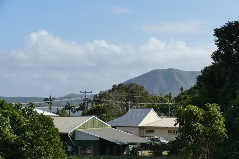
Cairns, being Queenslands fifth most populous city, was quite a new experience for us. Highways, traffic lights, congestions, and lots of people, including tourists from overseas. From our campsite on the outskirts, surrounded by rainforest, we drove into the city centre several times, went shopping (many of our clothes are simply used up), strolled along the beautiful Esplanade, enjoyed meals at cafés and restaurants. It is always amazing how quickly we get used to the comforts of civilisation and accept narrow campsites, light pollution and crowds.
One day we drove up the steep but very picturesque Reservoir Road up to Lake Morris, which is the major water supply for Cairns (Copperlode Dam).
View over the city of CairnsCopperlode Dam
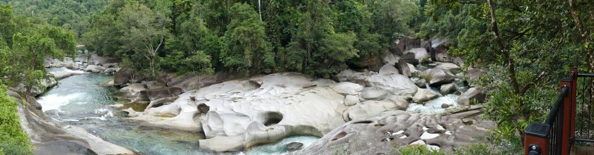
The road follows the face of the Whitfield Range and gave us magnificent panoramas over Cairns from different lookout points. Another lovely spot we found a few kilometres from our camp ground into the Redlynch Valley, where we explored the Crystal Cascades at the upper Freshwater Creek. We walked along numerous waterholes and waterfalls, but since the sun already had disappeared behind the mountains, a bath in the cool waters was not tempting. A truly magical place hidden deep in the rainforest.
Crystal Cascades
After five nights in Cairns, we drove south and spent the next night at Babinda Boulders, lucky to get a spot at this free and very popular campsite. We arrived in the afternoon, with the sun still shining on the crystal clear water and I jumped into the cool water for a refreshing swim. It was amazing, having the pool almost to myself (too cool for most of the people).
Further down the stream, the creek is lined with huge boulders. We walked along the pathway early next morning and were impressed by its beauty. The Babinda Boulders also holds great significance for local Aboriginal people. The call the place The Devil’s Pool, and according to the legend a beautiful girl, married to a respected elder from her tribe, met a handsome young man and they fell in love. Realising the adulterous crime, they were committing, the young lovers escaped their tribes and fled into the valley. They got caught, but the girl broke free and threw herself into the still waters. Her anguish cries for her lost lover turned the still waters into a rushing torrent and huge boulders were scattered around the creek, where the girl disappeared. Here spirit is believed to reside here today – she continues to call for her lover to return, enticing wandering travellers, especially men. Over the years, a number of young men have drowned on this very place…
Devil’s Pool at Babinda Boulders
We continued our travel to Paronella Park, another popular attraction of the area. It’s where the Spaniard José Paronella in the 1930s fulfilled his dream of building a castle surrounded by picnic areas at the lakeside, tennis courts, tunnels and bridges. It was meant as a sort of amusement park for the people of northern Queensland, and he certainly succeeded, getting a lot of attraction having North Queensland’s first hydroelectric plant. Unfortunately, regular floods and the use of wrong sand for the cement resulted in the place turning into ruins after two decades, and looks today much older than it actually is. Wandering around both at night and in daylight, we were fascinated by the fantasy, the love for detailing and the understanding of landscape this man must have had.
South Mission Beach was our next stop. We rented fatbikes one afternoon and had a lot of fun cycling on the beautiful beach.
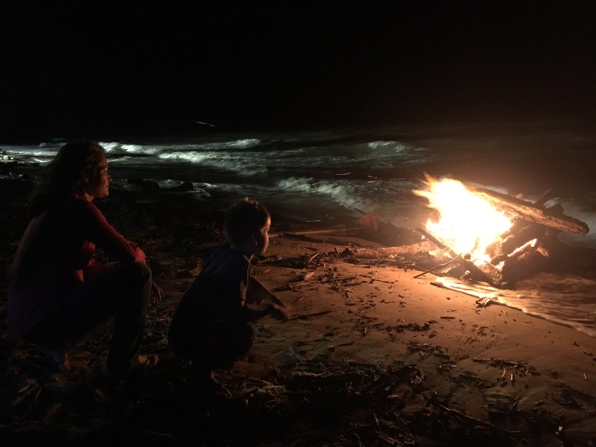
Campfire at Mission Beach
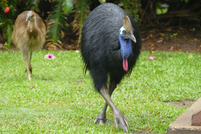
And we were lucky finally seeing cassowaries, the first time along the road while driving, the second time from close hold on the campground, wandering around next our tent.
Beware of the cassowaries!
We visited Tully Sugar Mill and learned about how sugar cane turns into brown sugar. We had seen the sugar cane being harvested all over Northern Queensland and being transported to the mills via the cane railway system. The factory reminded me more of a steamy, smoky and very noisy monster, than of a place where food is being produced. Men in dirty overalls looked more like machinists, which they indeed are, repairing and fixing the shredders, evaporators and centrifuges where needed. We got to taste still warm brown sugar, straight out of the centrifuge, and it tasted good!
Instead of driving all the way down to Wallaman Falls as originally planned, we decided to drop them and instead head westwards along the Kirrama Range Road. Driving along the steep and narrow road, with beautiful lookouts along the way, crossing small creeks and waterfalls, was stunning.
Tucker’s LookoutDriving on Kirrama Range Road
After a couple of hours through the mountainous forest, the landscape changed to open grassland savannah as we approached Blencoe Falls. The first lookout down Herbert River Gorge was beautiful, but the second, over Blencoe Falls, left us speechless. We were simply not prepared, didn’t know what to expect, and the view blew us away! It was the closet we ever got feeling like a bird.
Herbert River GorgeBlencoe Falls
We found a beautiful spot along Blencoe Creek where we put up our tent, being all by ourselves. We felt so lucky, seeing so much beauty on our very last days in our car. Robin played in the creek, we put up the tent and swag, lit a campfire and then made dinner. The night was cold but the starry sky as bright as ever. Simply stunning.
Bush camping at Blencoe Creek
The next day was our last whole day with our car. After seven months it is hard to imagine that we very soon will sleep inside a house again, eat our meals inside, don’t wake up with the birds. I must admit that I have very mixed feelings about getting home. Not so much because of everyday life, but because of losing this direct and constant contact to nature. Waking up every morning before the sun gets up, watching the sky slowly getting lighter, the nature around me coming to life. Preparing the first cup of coffee and sitting down with it, losing myself in the surroundings, becoming a part of it. I know it won’t be possible to maintain this once we’re back home. But luckily, living in Norway still gives us lots of opportunities to experience this in between work and school and other duties!
On our last day we followed the road up to Mount Garnet, where we had come through a couple of months ago. Instead of driving across the Tablelands again, we took off and drove through Wooroonooran National Park, or Misty Mountains, as they’re also called. We didn’t feel like spending the last night on a commercial camp ground and chose to spend it in the middle of the rainforest.
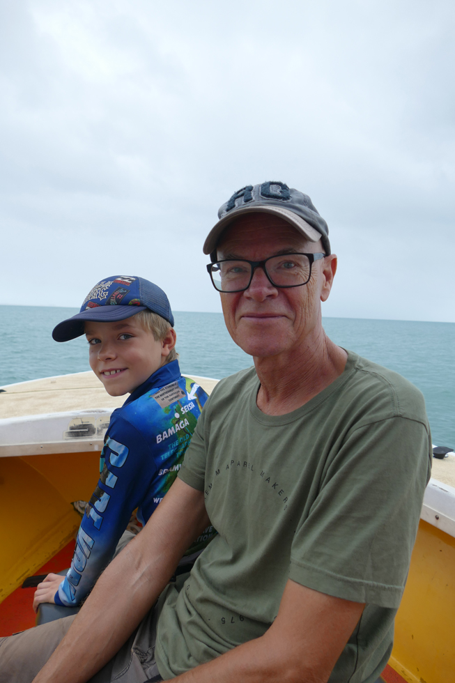
After reaching our last goal on the list, the Tip of Cape York, we realized that we still had a month left which means that we could really slow down and didn’t have to drive long distances anymore. Before we left Punsand Bay we booked a half-day tour to a pearl farm on small Roko Island.
On the way to Roko Island
It was just us on the tour, which was very nice, gaining a good insight into this small family business. Jason, the young farm manager showed us the shells hanging in special baskets in the sea, explained how small pearls are inserted into the shells, one by one and by hand.
His tools reminded us more of a dentist’s. Together with the pearl he plants a little flesh from another shell, which then starts growing the shining coat around the inserted pearl. All this is done through a tiny little gap – the shell can’t be opened too much in order not to damage it. After a couple of years, the grown pearl will be extracted the same way, before a new, smaller one is planted. A very slow and labour-intensive process!
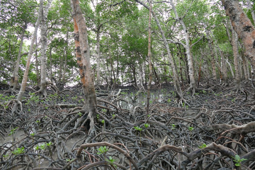
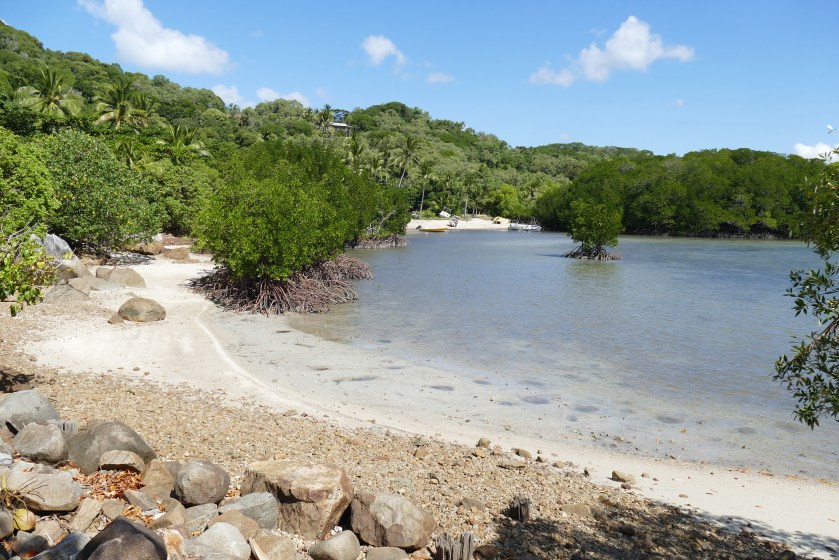
Mangroves on Roko Island
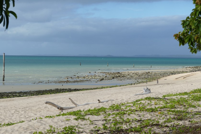
After Punsand Bay we drove out to Mutee Head on the east coast, a more remote campsite with beautiful views over the Torres Strait. Sitting around the campfire in the evening, watching the sea changing colour from light blue to black, the moon and the stars above us – it’s all so peaceful!
Mutee Head at low tide
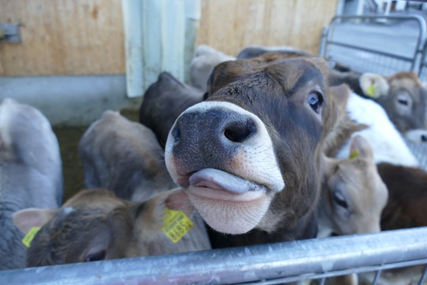
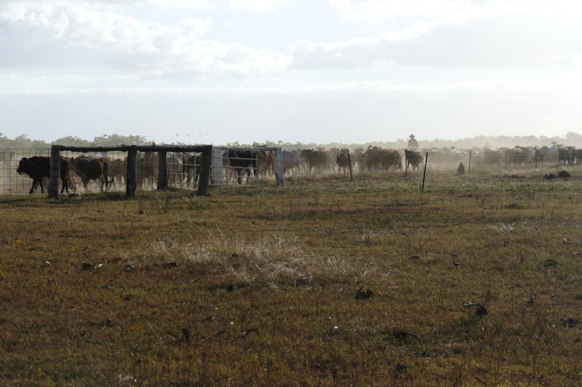
On the way south, we stopped at Bramwell Station, one of the old cattle stations on Cape York. They were in the middle of mustering the cows, using both a helicopter and squad bikes. Quite a spectacle and fascinating to watch. Less entertaining was the mooing of the cattle all night long, ensuring that none of us slept too well that night.
Mustering at Bramwell Station
We stopped for one night at Oyala Thumotang National Park, which most people leave out. Again, we had a camping site for ourselves next to a creek. We tried our luck fishing (no luck), had a great campfire in the evening and a quiet night.
From there we chose to drive back the same we as we came, crossing Lakefield National Park. From our campsite at Hann Crossing at the river shore, we spotted two pairs of eyes in the water, reflecting the light of our torches – no doubt that they belonged to crocodiles.
Camping at Hann Crossing
That’s a crocodile!
This made me move my swag a little further away from the edge, even if the river bank was steep and probably too big of an obstacle for the croc. But you never know… I peeked out several times during the night, making sure nothing was moving around me.
Back in Cooktown, Robin and Dag joined another fishing charter and for the first time came back with plenty of fish – and even more sand fly bites which obviously inhabit the mangroves. In the meantime, I climbed Mount Cook. I enjoyed having some time by myself and walking at my own pace. The track turned out to be quite narrow, steep and slippery, and at the top there was absolutely no view – just fog and drizzling rain. Never mind, there were beautiful views along the way, and walking through the dense rainforest is anyway stunning!
Quarantine Bay to the left, Mount Cook in the mist to the right
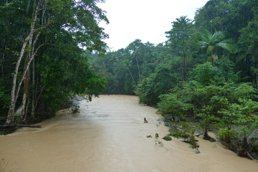
We had intended to spend a couple of nights a little further north at the beach, but stormy weather with heaps of rain forced us to change plans. We headed back to Cape Tribulation and spent one night in a cabin. Along the Bloomfield Track we realized how much it must have rained; water levels of creeks and rivers had risen significantly since we passed through a month ago.
River crossing along the Bloomfield Track
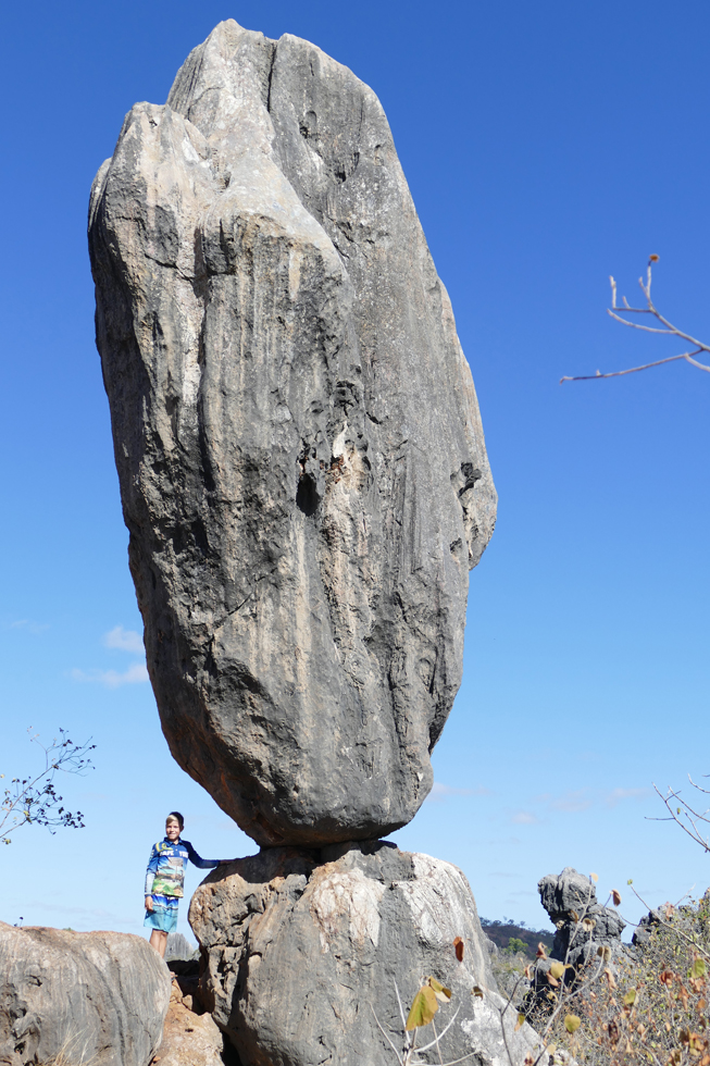
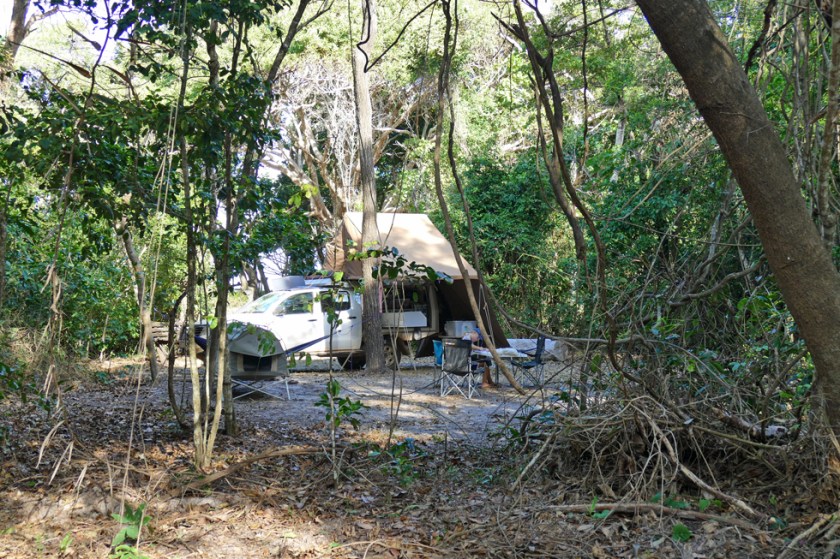
Next day we moved over to the camping, put up our tent and got it a little dry at least. Roof top tent and swag are not the most comfortable place to be when it’s raining in the Wet Tropics, that’s for sure…! But at least it is not cold, which helps a lot. Robin and I went on a ‘Jungle Surfing’ tour, flying on ziplines up to 20 metres above the ground, through the Daintree Rainforest. We had a lot of fun! After another very wet night we decided to leave the coast for a couple of days. Inland usually has better, dryer weather. Driving three hours west to Chillagoe, land and weather had changed. From wet rainforest we were now in dry and warm savannah landscape – just what we needed. Chillagoe is known for the Mungana Caves, a system of between 600 and 1000 limestone caves surrounded by spectacular karst landscape.
Sandstone bluff around Chillagoe
Balancing Rock at Chillagoe
Chillagoe, one hundred years ago hosting 13 hotels, two newspapers, a hospital and population of over 10’000 people, is today a quiet but charming little town with around 200 inhabitants. We liked its outback charm, the beautiful light and amazing starry sky. Going to the general store and hardly getting any food, because the truck with new supplies arrives the day after. We really love these places where time has stood still…
We visited two of the limestone caves, Trezkinn and Royal Arch Cave. The second one was especially fascinating, not being light up at all. We all got torches and went down into the darkness, following a steep and narrow path through different caves, admiring beautiful stalactite and stalagmite formations.
Trezkinn Cave
Our guide Greg told us a lot about the caves, how they were created, how they got discovered, which animals inhabit them (bats, spiders and snakes), which animals they must fight (feral cats and cane toads) and about all the different task the rangers are responsible for. He was very enthusiastic and informative! No wonder Robin talks about becoming a cave explorer after meeting him. After the guided tours we went to see the Archways on our own, a semi open cave system with open shafts and shadowy tunnels. A real adventure!
It certainly was the right choice driving inland, leaving the coast and bad weather behind us. Getting once again the feeling of the outback was awesome – we are going to miss it!
After an easy drive up to Weipa things are more serious from Bramwell Junction a bit further north on the peninsula. That is where the Old Telegraph Track starts. The track was constructed as the telegraph line pushed north from Cooktown to the Tip and was completed in 1887. And while most of my readers probably don’t know much about it, I can assure you it is one of the most prestigious and extreme 4WD roads in whole Australia. And it’s been one of Dag’s big dreams to drive at least parts of it. After months on the road, knowing our car and driving skills inside out, we felt ready for it!
Ready for the Old Telegraph Track at Bramwell Junction
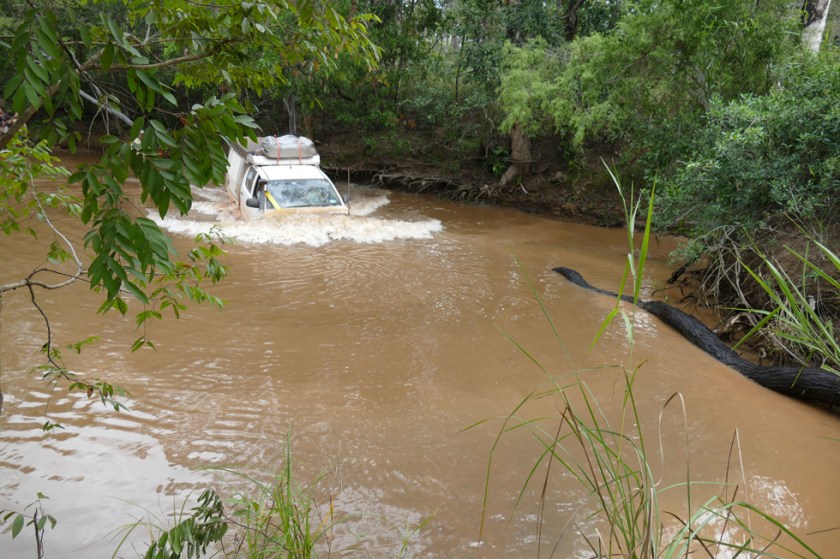
Just a few kilometres on the track we met the first big challenge, a creek which even didn’t have a name and turned out to be too steep for us on its way out. But luckily, you’re never alone on the OTT, as the track is called. There are plenty of other adventurers driving it and they always help when needed. So a party of three cars and three couples pulled us up with their winch and we continued together with them the rest of the day.
Another two kilometres and we reached Palm Creek, another infamous crossing that turned out to be very steep and very deep. We let the other cars drive first and Dag made his way through it without any further help. The water got all the way up over the bonnet! I must admit that I never sat in the car through the worst crossings – I attended to my duties as the trips photographer.
Crossing Palm Creek
To be honest, I am just too afraid to sit in the car when it is getting too rough, and prefer to get wet, crossing the creeks by foot. Robin on the other hand enjoys it greatly and doesn’t have to be asked twice whether he wants to sit in front. We did many crossings during that afternoon, but fortunately they weren’t as difficult as the first ones! And Dag is an EXCELLENT driver, making it through this track without ruining the car. We saw many others that weren’t so skilled! After many hours of driving we spent the night in the middle of nowhere, close to Dulhunty River. You might think you’re alone in such a remote place, but there were at least 25 other cars. Not my favourite type of bush camping but fun to see how popular this kind of holiday making is here in Australia!
The next day we continued a short while on the OTT and passed another two crossings, then we got on a bypass to avoid the Gunshot Crossing, the most feared of them all. No way we would have tried that one – we have seen pictures and that’s enough. Just google it and you’ll understand what I am talking about.
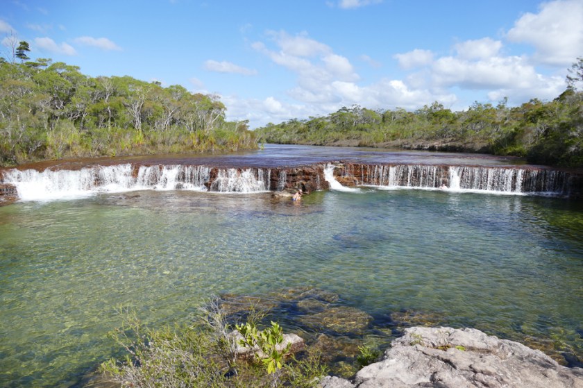
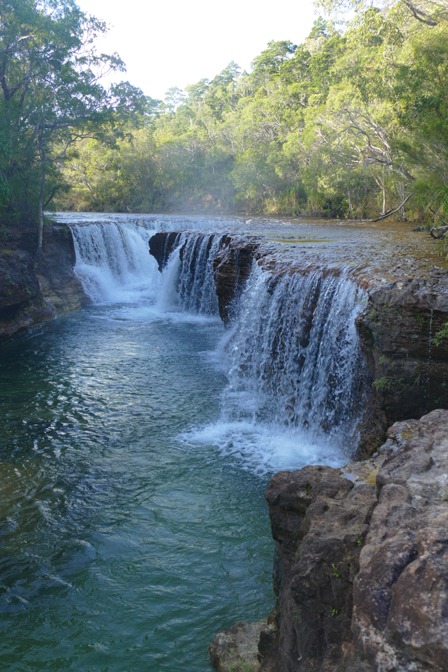
Apart from 4WDriving there are quite a few beautiful places along the OTT where you can go for a swim: waterholes and waterfalls (and without crocs). We spent two nights at Eliot and Twin Falls on a nice camping ground just next to the creeks with great swimming holes. Robin met friends again from Cape Tribulation and we shared a campfire with them in the evening. That’s one of the great things about driving on Cape York, everybody is heading the same way and you run into the same people again and again.
Fruitbat Falls
Eliot Falls
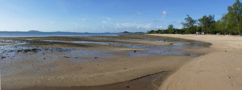
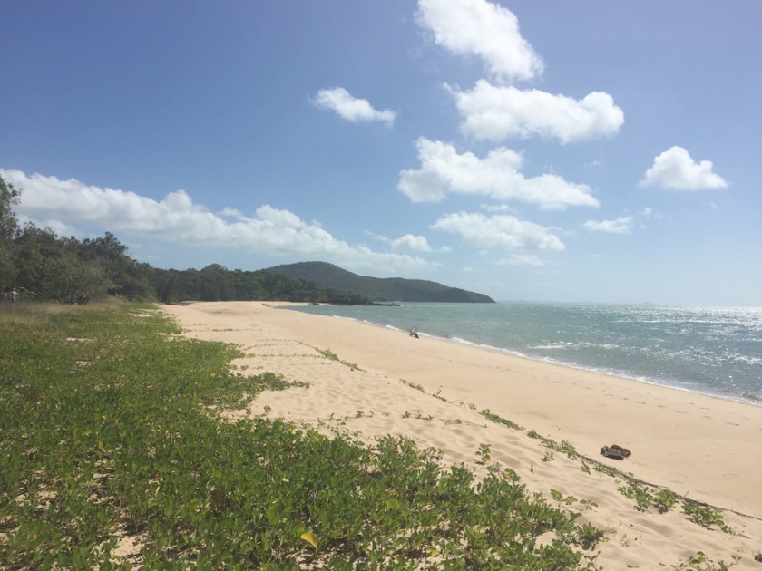
We continued a little bit on the northern part of OTT, but only until Mistake Creek where we took another bypass. From here we followed the main road (very dusty and corrugated) all the way up to the Jardine River Ferry and from there to Loyalty Beach. We did a day trip to Thursday Islands, one of the many islands in the Torres Strait.
Loyalty Beach
Small islands off Loyalty Beach
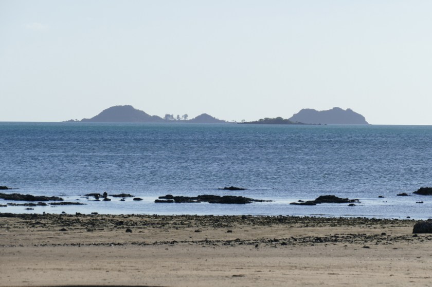
The landscape reminds me a lot of Southeast Asia, the sea is of an incredible turquoise colour, the islands countless and most of them uninhabited. The ferry trip from Seisia to Thursday Island was simply stunning. Once on the island we strolled around in the little village, then joined a tour in a bus taking us around, giving us information about the history of the place.
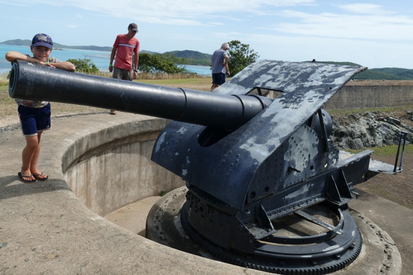
Thursday Island is one of the smallest of the Torres Strait Islands, but thanks to its sheltered location between the other islands, it has one of the longest histories and is today the most populated (about 3’000 people) of all the islands of the Torres Strait. We learned about famous ship wrecks, the pearl industry and of course the islands role during WWII.
View from Green HillThe Fort on Green Hill
And then we finally drove all the way up, putting our camp up at Punsand Bay, where we run into other friends of us, spending a lovely evening together with pizza and games.
Punsand Bay
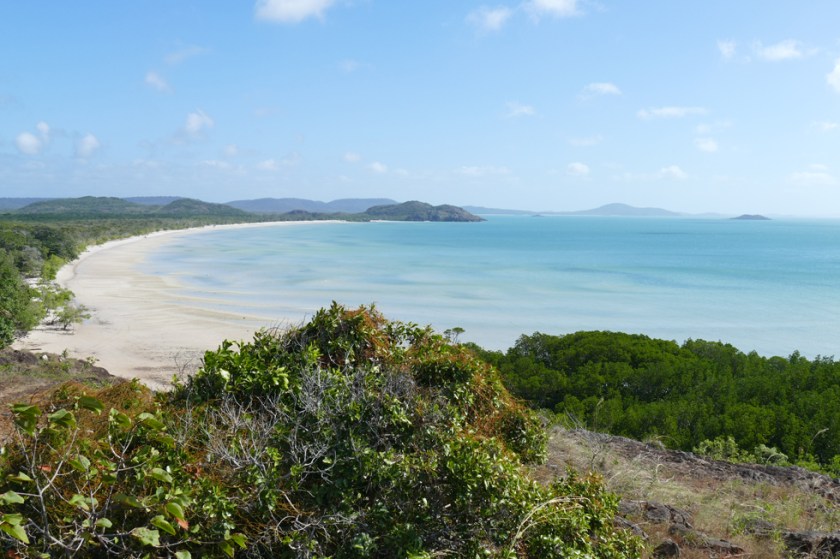
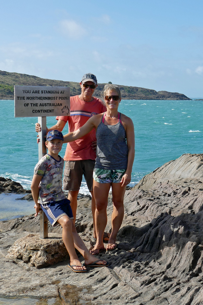
From Punsand it is only about 50 kilometres up to the northernmost point of the Australian continent. From the carpark we did the easy walk over a rocky headland with beautiful views over emerald blue waters. At the tip we took the obligatory photographs of us in front of the sign, and remembered the day about three months ago when we stood at Australia’s westernmost point. Aren’t we lucky to see all these amazing places!
Beautiful coastline on the way to the TipWe made it!
We are still just halfway up the Peninsula – no reason to rush. We’ve got plenty of time and there is so much to see.
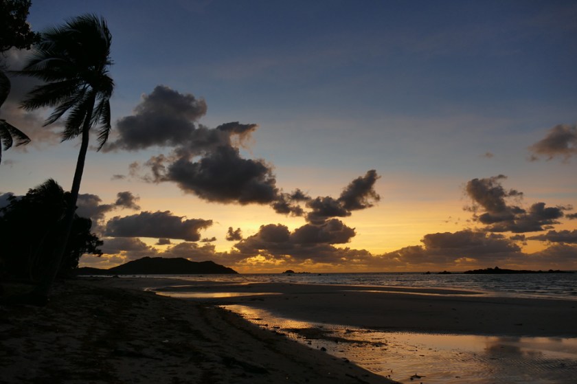
Sunrise at Chili Beach
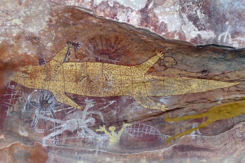
About 200 kilometres northeast of Port Douglas is Laura, a small town well known for the Quinkan (an Aboriginal mythological being) Aboriginal art country that surrounds it. It is supposed to contain some of the best Aboriginal art sites in the whole Australia and are listed by Unesco as amongst 10 top pre-historical rock art sites in the world. Humans, animals, tracks and spirits have been painted on the rock walls, always under an overhang and well protected from rain.
We were told that there are about 1’200 sites around Laura, and new ones are still being discovered. The land is quite inaccessible, with lots of rock boulders that hide the art sites. Only a handful are open for public, and of these you’re only allowed to visit one site without a guide, the Split Rock Group. So that’s where we started. We walked the path up the hillside all by ourselves and reached the sandstone escarpments covered with paintings thought to date back 14’000 years. It is somehow a quite surreal experience, realizing that humans have been living here for such a long time, only to be nearly extinguished by the European and Chinese settlers. With them a lot of their culture and language disappeared as well.
We joined a guided tour to see the so-called Quinkan Galleries, a collection of several rock art sites around some sandstone boulders and cliffs buried deep in the bush. Even if The Galleries are being considered for World Heritage status, nothing indicates its international or historical significance on site. The paintings are done with ochre in red, white and brown, a few in yellow. They have been layered on top of each other, each tribe adding more each time they passed through the camp. Our guide explained us that this particular site is believed to have been used for initiation ceremonies, where young boys are formally entering adulthood. He showed us a narrow tunnel in the sandstone, connecting one overhang with the other. This is where the boys had to crawl through as a proof of their courage. Most of the images are of animals, most likely what the tribes ate or saw. Others show figures of the spirits from which the site gets its name. Stenciled handprints, used as signatures, accompanied the drawings.
It was beautiful and impressive, especially thinking about the fact that the whole area is covered with secret sites like that!
From Laura we continued to Lakefield National Park, which is the largest national park in the Cape York Peninsula. It’s all open woodlands and grasslands, wetlands, rivers, and mangrove mudflats, on some very flat land breaking up the Great Dividing Range. Not much to do other than enjoy the nature with its abundance of birds.
Some people obviously go canoeing on some of the lagoons, though it’s crocodile country and accidents have happened… so we always keep a safe distance to all the waters.
Magnetic termite mounds in Lakefield NPBreakfast at Kennedy Bend, Lakefield NP
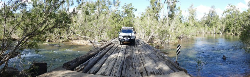
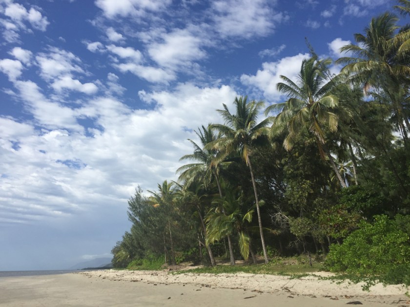
After one night in the small town of Coen, where we filled our fridge again, we drove the long and partly quite rough road west to Iron Range National Park. It was a very varied and scenic drive. For most of the journey the road winds about through hilly country, including many wet crossings and passing through eucalypt and paperbark forest, then further east the largest remaining area of lowland rainforest in Australia. Once we reached the coast it felt like we had arrived in paradise – Chili Beach, where we spent the next three nights is stunning! Fine white sand fringed with high coconut palms and dense rainforest right behind.
Living in the jungle at Chili Beach
We did long walks along the beach (not swimming – there’s crocodiles all over Cape York), Robin spent hours building a beautiful Beach House (you use with what you find!).
One night we went animal spotting with torches through the forest (didn’t see much, just a frog). We ate a nice lunch at ‘The Out of the Blue Cafe’ in nearby Portland Rivers, a tiny place with about five houses and including this gem of a café with the most stunning view.
Portland Rivers
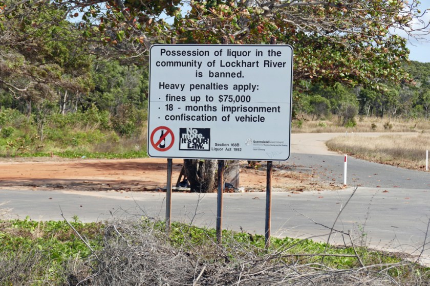
We also drove to Lockhardt River, the nearby Aboriginal community. Before leaving we had to take wine and beers out of our car and leave at the campsite – as in so many other places on Cape York there are alcohol restrictions visiting the community. Unfortunately, the art centre in town, which was the main reason why we went there, was closed – the guy had gone on a walkabout we were told.
Chili Beach would have been perfect, hadn’t it been for all the marine debris along the beach. A sign informed us that more than 5 tonnes is removed from the beach every year (they must have cleaned up recently since it didn’t look too bad when we were there), 90% of it being washed ashore from the ocean. More than 6’500 plastic bottles and 4’700 rubber thongs were counted. It was a strong reminder that we must focus on reducing our plastic waste.
After three peaceful days on the east coast we continue, heading over to the west side, visiting the mining town of Weipa. There we’ll be able to stock up, before we hit the red dust again and drive all the way up to the tip.
Leaving Port Douglas heading North, there is several roads one can choose. Inland on bitumen road, where all the people with caravans drive, or along the coast, through the Daintree Rainforest. There is much more to see along the scenic coastal route, so this is what we chose. From Port Douglas it was only a short drive to Mossman Gorge, where we did a walk through beautiful ancient rainforest.
The Daintree is one of the few places where the rainforest meets the reef, but it is its age that really sets it apart. At the Daintree Discovery Centre we learned that it is thought to be around 180 million years old (the Amazon is about seven million years old).
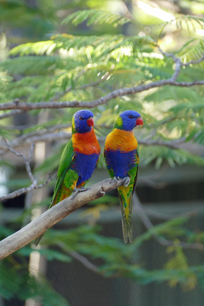
The forest is home to some of the oldest plants on Earth and the richest fauna diversity in Australia. We were really hoping to see a cassowary (the picture below is from Wildlife Habitat in Port Douglas), one of the most iconic Australian animals, but didn’t have any luck. We only saw many so-called Cassowary Plums, one of its favourite food (very toxic to all other creatures).
Never mind, walking through this stunning landscape, stopping at many of the viewing platforms, listening to the sound of water running by, observing the diverse shapes, colours and sizes of leaves – it was magic! Maybe the drizzling rain also played its part for making this place so fascinating to me. Water dripping everywhere, wafts of mist hanging in the highest trees, sunbeams filtering through the canopy. I could just have stayed here, sit and observe, immerse myself into this green paradise.
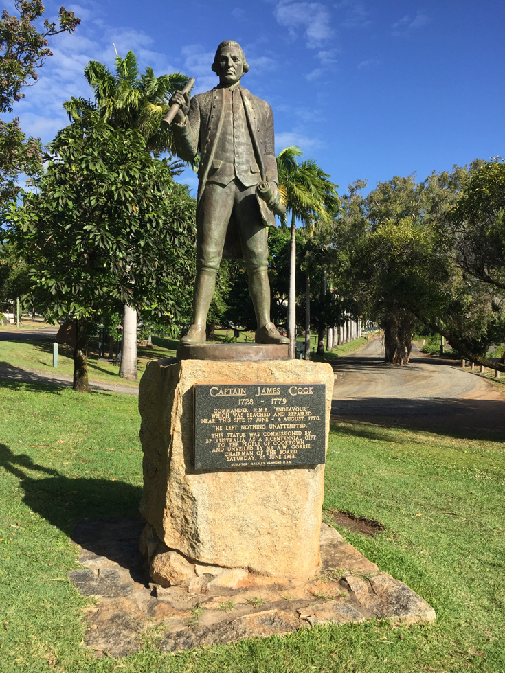
We continued north and spent one night at Cape Tribulation, where Captain James Cook and his ship the HMB Endeavour ran afoul on the Great Barrier Reef in 1770.
South of Cape Tribulation
It’s a fascinating story: to float the ship off the coral reef, over 50 tons weight was thrown overboard. Finally on the next high tide she floated free, but started rapidly taking in water. Not to mention that the men couldn’t swim nor were there sufficient life boats for all. While some men took their turns at the pumps, trying to avoid that the ship would sink, others managed to repair it temporarily, covering a sail with oakum, dung and sheep’s wool and drawing it under Endeavour’s belly. Like this Cook managed to sail his vessel along the coast, trying to find somewhere to repair the ship. They finally landed at what today is named the Endeavour River (Waalumball Birri). This is where, approximately hundred years later, the first tents and pre-fabricated buildings began to appear and Cook’s Town it was born.
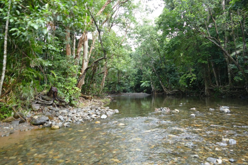
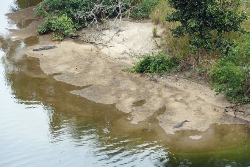
After a stormy and rainy night (it obviously never stops blowing along this coast) we headed for the Bloomfield Track, a 4WD track up to Cooktown. This beautiful rainforest track winds its way along the coastline, soaring up steep mountain passes and descending to river crossings. We did a short walk to Bloomfield Falls, well aware of the crocodile on the other river bank keeping an eye on us…
River crossing on the Bloomfield TrackTwo crocs lying on the river bank
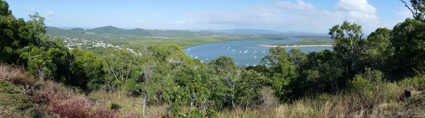
Arriving in Cooktown, the weather was still quite stormy, with strong gusts of wind and short heavy showers of rain. It was the last remnants of the rain season. Fortunately next day the sun came out and the wind blew away all the clouds. What a stunning place this is. Surrounded by forest clad hills, on the shore of Endeavour River meandering through the land, eventually flowing into the Coral Sea. We walked up to Grassy Hill Lighthouse where we had breathtaking panorama views of the town, the river and the sea.
View from Grassy Hill
During our stay we also visited James Cook Museum and Cooktown History Centre, the Botanical Garden and tried our luck fishing from the wharf (no luck, but good fun). There is not that much more to do in this little town, but we liked this friendly little place with its beautiful heritage buildings. Also here we could have stayed longer.
Cooktown is full of heritage architecture
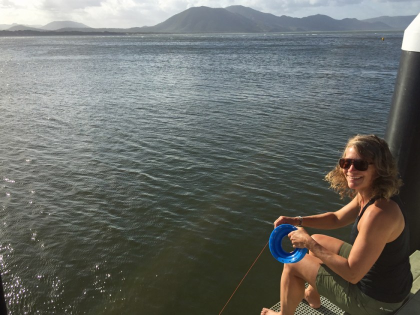
Fishing in Endeavour River
But we had to get back to Port Douglas once again, having an appointment Friday 7 am at the local car mechanics, to get our brakes fixed. It is essential to have a car in tip-top shape before heading for the rough tracks on Cape York Peninsula.
We have reached the tropical Northern Queensland. And suddenly everything is SO GREEN. And I realize that this is my favourite colour. It makes me happy, it calms me, I just can’t get enough. All these beautiful shades of green in the rainforest. It is so totally different from the landscapes we have been driving through the last months! Not that I didn’t love each and every one of them, it probably just comes as a shock to me.
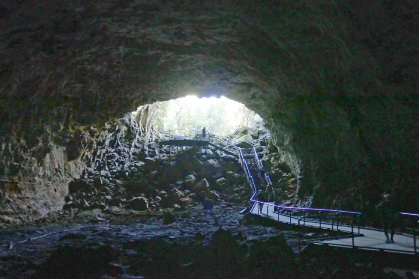
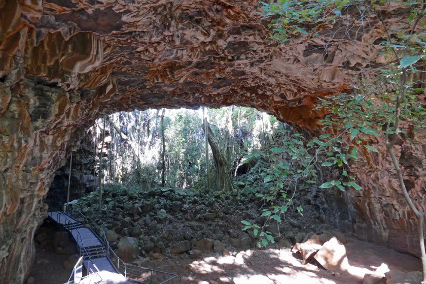
On the way to Port Douglas, where we are staying now, we stopped at a few special places. Probably one of the most remarkable ones was Undara National Park. The park contains the remains of the Earth’s longest flow (160 km) of lava originating from a single volcanic crater. The volcanic activity that formed the lava tubes occurred around 189’000 years ago, when the volcano Undara expelled massive amounts of lava onto the surrounding areas. It then developed a continuous and hard crust, which thickened and formed a roof above the still-flowing lava stream. We visited Stephenson Cave, one of several lava tubes that remain today, and The Arch, a short section that did not collapse. Quite impressing I must admit walking through these tunnels, 15 metres high and almost 20 metres wide.
Stephenson CaveThe Arch
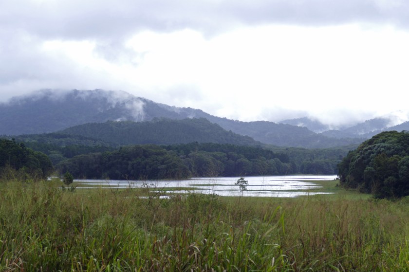
The next few days we spent in the Atherton Tableland, a fertile plateau which is part of the Great Dividing Range. We became quickly aware of the fact that we were on a highland, since it suddenly got much cooler, and we even had fog and drizzling rain.
Atherton Tableland
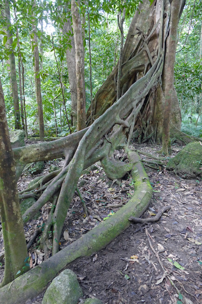
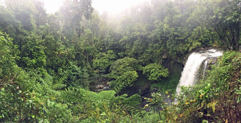
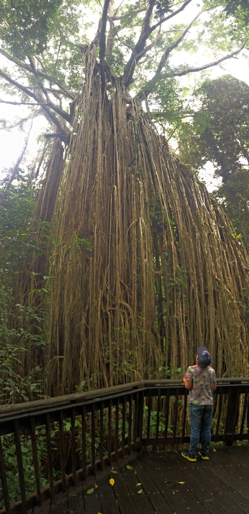
We visited several of the small national parks, many of them remnants of the rainforest which once covered the entire area, before the timber cutters arrived. They feature crater lakes, waterfalls and massive trees like the Curtain Fig Tree, with roots that drop 15 metres to the ground.
Zillie Falls
Millaa Millaa Falls
Robin in front of the Curtain Fig Tree
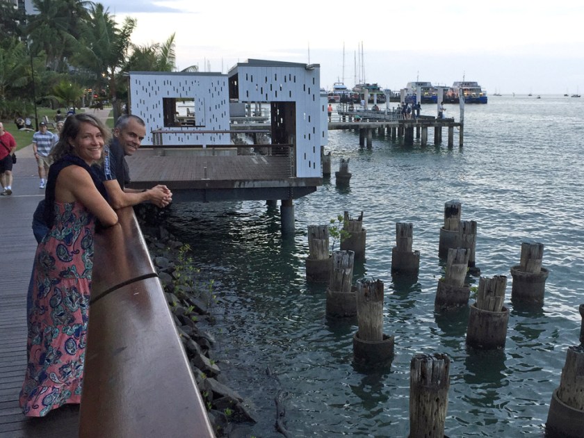
With our birthdays coming up, we decided quite spontaneously to book an apartment in Port Douglas, the next destination on our route. It was a bit like coming home: this is where we spent Christmas 2013 in the very beginning of our first trip to Australia. As much as we love travelling with our car, sleeping outside and being out in nature, it is very pleasant to have a little comfort for a few days! So this is what we’ve done the last days: nothing much. Celebrating birthdays, hanging around the pool, shopping, walking along the beach, going out for dinner and getting another service for our car. Quite nice for a change.
We also become more and more aware of the fact that our trip is eventually coming to an end. It is a somehow scary thought to me, not really knowing how I will react once we get home. Will we be restless? Will we feel locked in after being outside for months? How will we cope with the lack of sun? But I am confident as well. We will manage to adopt again, friends, family and work will help us returning to our normal life. Time will show…
At Four Mile Beach Port DouglasView from Flagstaff Hill Lookout, Port Douglas
But first we are ready for hitting the road again and explore Cape York Peninsula!
We have put quite a few kilometres behind the last week and have crossed another state border: from Northern Territory to Queensland. This is our seventh and last state, which also means that the last part of our trip has begun. Good to remember that we still have two months to go…
Once we reached Stuart Highway, the famous highway connecting Port Augusta in the South with Darwin in the North, we stopped at Devils Marbles, just south of Tennant Creek. The Devils Marbles, called Karlu Karlu in Aboriginal language, is another geological wonder. Large boulders have been eroded over 1500 million years, forming a bizarre landscape of round rocks standing seemingly weightless on top of each other.
After climbing the big boulders at Tower Rock all by ourselves, we weren’t as impressed of the Marbles as we probably should. It is just not as magical with all the other tourists, the big highway close by, public toilets and drones flying over us.
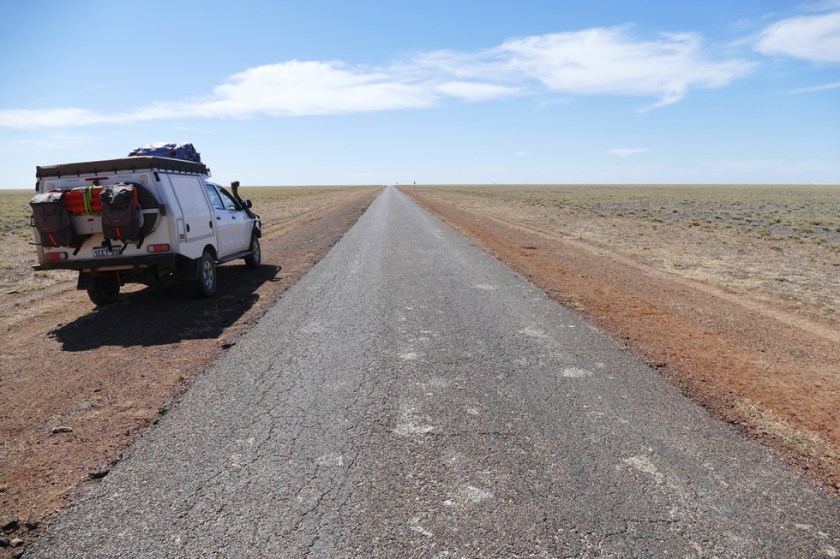
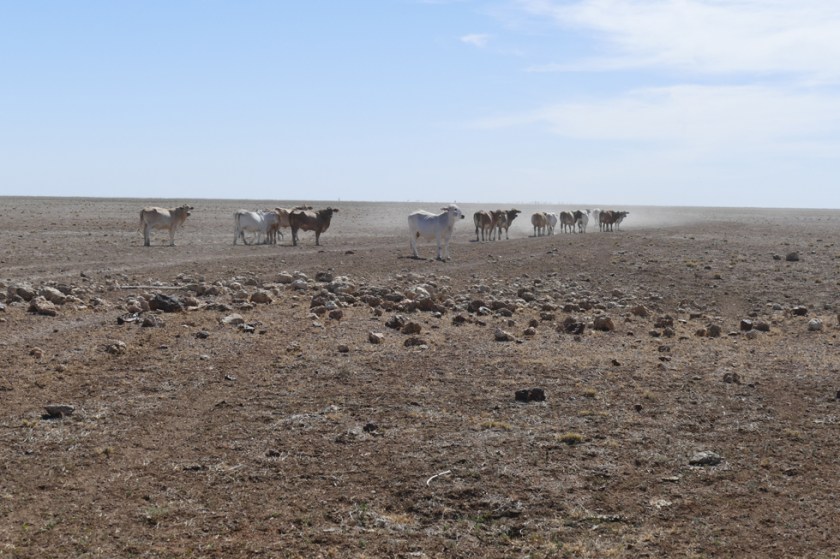
In Tennant Creek we only stayed one night, filled our fridge, got a shower and did the laundry. From there we headed north to a place called Lorella Springs. To get there we chose not to follow Stuart Highway, but a smaller, more remote road, the Tablelands Highway. It brought us through a real ‘nullarbor’ plain, without anything as far you could see, only cattle here and there.
On the Tablelands Highway
Lorella Springs is a huge 4000 square kilometres cattle station turned into a wilderness park for 4WD enthusiasts and fishing lovers. We enjoyed the warm springs at the homestead and swimming in rockpools, but found some of the tracks a bit too rough. Driving at 5 to 10 kilometres per hour, risking our tires, is nothing we enjoy too much. Our car is simply too heavy for this type of driving.
From Lorella Springs we followed the Savannah Way eastwards. This is yet another long-distance outback driving route that links Broome in the West to Cairns in the East. It joins several small towns, most of which were born of late 19th Century gold rushes. The landscape towards the border wasn’t too varied, sparse bushland for hours – what really was a lot of fun (and quite dangerous at times), were all the wild animals along the road. Apart from all the cattle (domestic) crossing our way, we saw wild horses, many birds of prey enjoying the carcasses (run over kangaroos), lizards, kangaroos and wallabys, a dingo, and even wild boar.
It meant being alert all the time, slow down and make sure they didn’t run in our way (which they often do). Just before the Queensland border we had a flat tire – it was just too many rocks at Lorella Springs! Never mind, we have two spare tires and it only meant that we reached our goal (Hellsgate Roadhouse) an hour later.
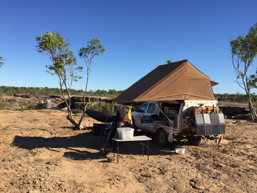
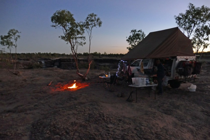
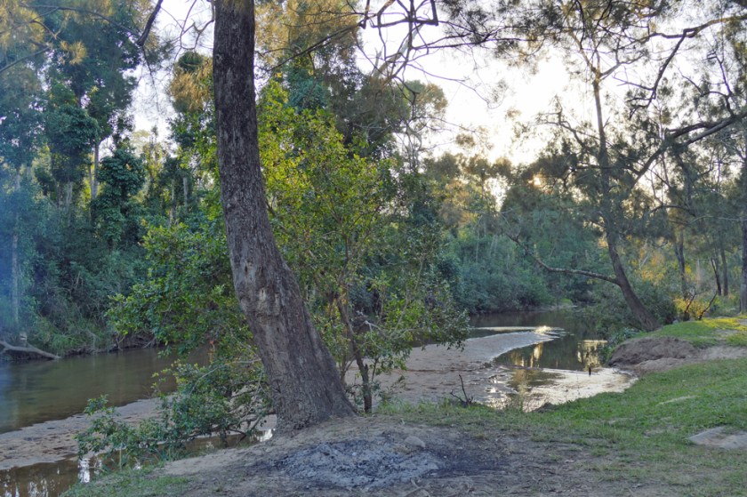
One night we spent at Leichhardt Falls, a beautiful place next to Leichhardt River, well above the river bed and safe from the crocodiles along the river bank. I can only repeat myself: the best camping is in the bush, under a million stars at night. Much better than any 5-star hotel, if you ask me!
Beautiful Leichhardt Falls
Whenever we can we have a campfire
In Normantown we stopped to do some shopping and get our tire repaired. We were surprised about this little town with streets wide enough to land a 747 on, originally service town for the cattle stations and sea port for the gold mines in the area. The roads were lined with quite a few interesting colonial buildings like the train station, an old store building and several hotels.
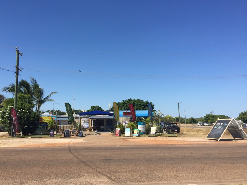
From here we continued to the coast. The only place where you get to the Gulf of Carpentaria on a bitumen road is in Karumba, a small town being very popular among the fishing loving grey nomads.
Main street in Karumba
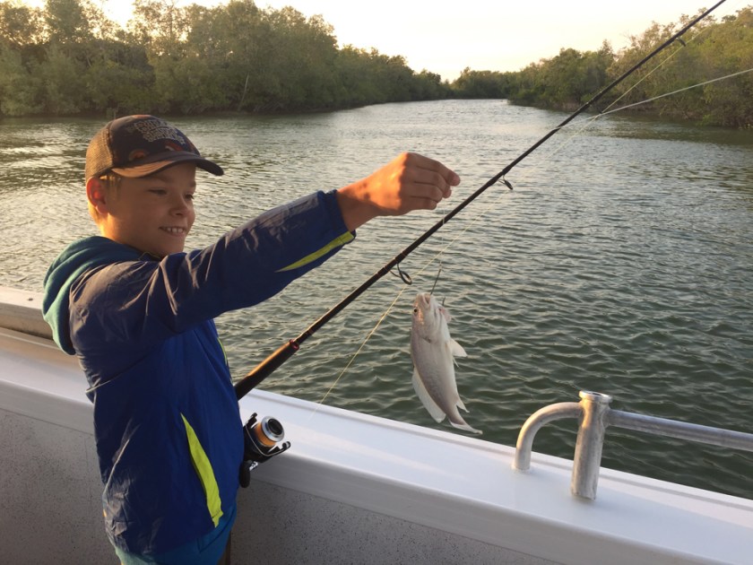
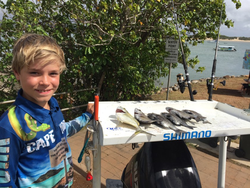
Dag and Robin joined a half day fishing charter and caught a lot of fish, unfortunately most of them too small to keep. But they had a lot of fun!
Well done!
During the two days in Karumba we finally put our car for sale on the internet. Please keep your fingers crossed that we find a buyer!


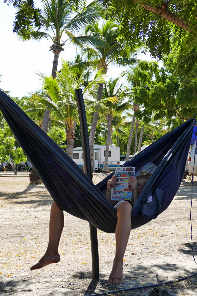
 The week went by quickly. Days filled with long breakfasts, walks, playing games and cosy dinners.
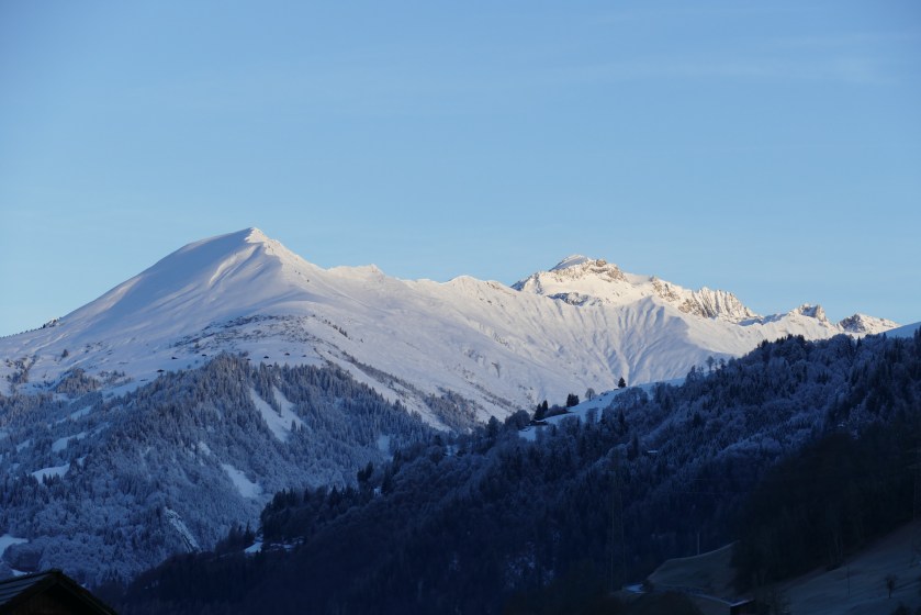

 A week has passed since we came home last Sunday. It feels like having woken up from a long, beautiful dream. I have to pinch myself in between, telling myself that it actually is real, all the memories, all the pictures in my head. And it’s just a week ago.


 Packing was quite a hassle, trying to fit everything into our bags. We ended up with 88 kg, 90 being allowed… Again, my brother was of great help, driving us to the airport. And that was it.
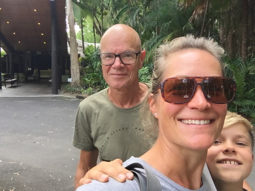


 In the meantime, I climbed Mount Cook. I enjoyed having some time by myself and walking at my own pace. The track turned out to be quite narrow, steep and slippery, and at the top there was absolutely no view – just fog and drizzling rain. Never mind, there were beautiful views along the way, and walking through the dense rainforest is anyway stunning!


 After an easy drive up to Weipa things are more serious from Bramwell Junction a bit further north on the peninsula. That is where the Old Telegraph Track starts. The track was constructed as the telegraph line pushed north from Cooktown to the Tip and was completed in 1887. And while most of my readers probably don’t know much about it, I can assure you it is one of the most prestigious and extreme 4WD roads in whole Australia. And it’s been one of Dag’s big dreams to drive at least parts of it. After months on the road, knowing our car and driving skills inside out, we felt ready for it!


 We have reached the tropical Northern Queensland. And suddenly everything is SO GREEN. And I realize that this is my favourite colour. It makes me happy, it calms me, I just can’t get enough. All these beautiful shades of green in the rainforest. It is so totally different from the landscapes we have been driving through the last months! Not that I didn’t love each and every one of them, it probably just comes as a shock to me.


 Lorella Springs is a huge 4000 square kilometres cattle station turned into a wilderness park for 4WD enthusiasts and fishing lovers. We enjoyed the warm springs at the homestead and swimming in rockpools, but found some of the tracks a bit too rough. Driving at 5 to 10 kilometres per hour, risking our tires, is nothing we enjoy too much. Our car is simply too heavy for this type of driving.